Parent Directory
Parent Directory
Parent Directory
| Start time | End time | Last Latitude & Longitude |
Current (1hr avg) |
|---|---|---|---|
| 1980/03/05 22:33:44 GMT 1980/03/05 14:33:44 local |
1980/03/06 00:34:45 GMT 1980/03/05 16:34:45 local |
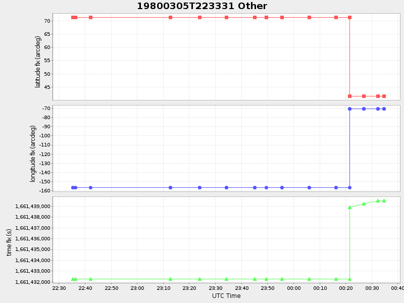
41.52431149967077 -70.67184766623535 |
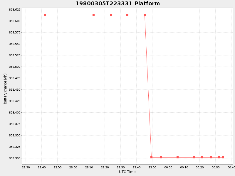
0.30870716376796503 Amp |
| Downloads: | ||||
| shore.nc shore.mat |
shore.kml shore.kmz |
shore.asc shore.dir |
shore.csv shore.log |
argos_24hr.kml argos_week.kml, argos_month.kml |
| Elapsed time since start: ... | Elapsed time since last valid data: ... |