Parent Directory
Parent Directory
Parent Directory
| Start time | End time | Last Latitude & Longitude |
Current (1hr avg) |
|---|---|---|---|
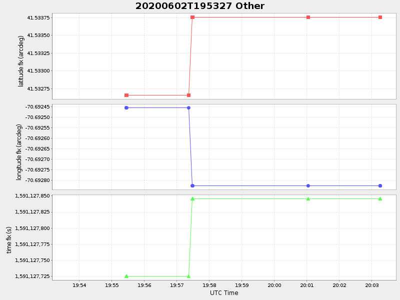
| 2020/06/02 19:53:39 GMT 2020/06/02 12:53:39 local |
2020/06/02 20:03:15 GMT 2020/06/02 13:03:15 local |
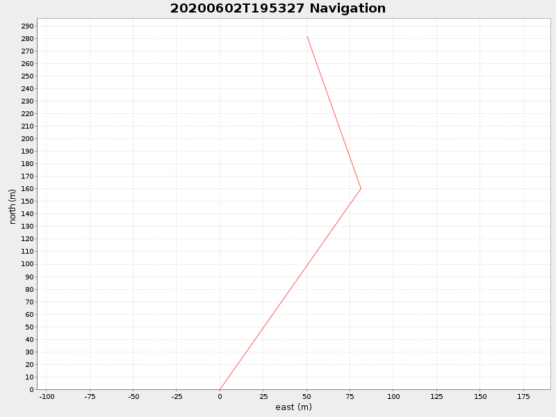
41.53375316647997 -70.6928269999813 |
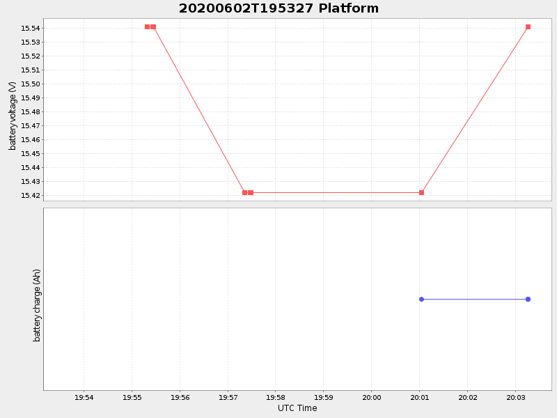
-0.0 Amp |
| Downloads: | ||||
| shore.nc shore.mat |
shore.kml shore.kmz |
shore.asc shore.dir |
shore.csv shore.log |
argos_24hr.kml argos_week.kml, argos_month.kml |
| Elapsed time since start: 44297:09 | Elapsed time since last valid data: 44296:60 |