Polaris 20201111T233626 Parent Directory

Open page with static plots
Start timeEnd timeLast Latitude
& Longitude
Current
(1hr avg)
2020/11/11 23:39:36 GMT
2020/11/11 15:39:36 local
2020/11/12 01:54:38 GMT
2020/11/11 17:54:38 local
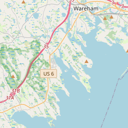
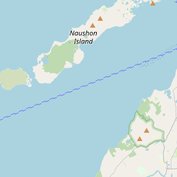
41.55304481817844
-70.70932155164371
2.0041472060702303 Amp
Downloads:
shore.nc
shore.mat
shore.kml
shore.kmz
shore.asc
shore.dir
shore.csv
shore.log
argos_24hr.kml
argos_week.kml, argos_month.kml
Elapsed time since start: 40356:02 Elapsed time since last valid data: 40353:47
MarkerMarker
Leaflet © OpenStreetMap contributors
Options for all plots below with a time axis:


Created with Highstock 6.1.3time (UTC)Depth (m)Vertical Plane23:4512. Nov00:1500:3000:4501:0001:1501:3001:45-5-2.502.557.510ZoomAll1h3h6h12h1d3d1wFromNov 11, 2020ToNov 12, 2020Highcharts.com
Created with Highstock 6.1.3time (UTC)Depth (m)bin_median_temperature (degC)bin_median_salinity (psu)Science Sections23:4512. Nov00:1500:3000:4501:0001:1501:3001:45-5051013.313.3513.413.4532.2632.2732.2832.2932.332.31ZoomAll1h3h6h12h1d3d1wFromNov 11, 2020ToNov 12, 2020Highcharts.com
Created with Highstock 6.1.3degC13.428 -13.422 -13.416 -13.410 -13.405 -13.399 -13.393 -13.387 -13.381 -13.375 -13.370 -13.364 -13.358 -13.352 -13.346 -13.340 -13.334 -13.329 -13.323 -13.317 -time (UTC)Depth (m)Science Section: CTD_Seabird.bin_median_temperature23:4512. Nov00:1500:3000:4501:0001:1501:3001:45-5-2.502.557.510ZoomAll1h3h6h12h1d3d1wFromNov 11, 2020ToNov 12, 2020Highcharts.com
Created with Highstock 6.1.3psu32.307 -32.305 -32.303 -32.301 -32.300 -32.298 -32.296 -32.294 -32.293 -32.291 -32.289 -32.287 -32.286 -32.284 -32.282 -32.280 -32.278 -32.277 -32.275 -32.273 -time (UTC)Depth (m)Science Section: CTD_Seabird.bin_median_salinity23:4512. Nov00:1500:3000:4501:0001:1501:3001:45-5-2.502.557.510ZoomAll1h3h6h12h1d3d1wFromNov 11, 2020ToNov 12, 2020Highcharts.com
Created with Highstock 6.1.3time (UTC)bin_median_salinity (psu)bin_median_temperature (degC)CTD_Seabird12. Nov00:1500:3000:4501:0001:1532.2632.2732.2832.2932.332.3113.313.32513.3513.37513.413.42513.45ZoomAll1h3h6h12h1d3d1wFromNov 11, 2020ToNov 12, 2020Highcharts.com
Created with Highstock 6.1.3longitude (arcdeg)latitude (arcdeg)Navigation-70.709-70.708-70.707-70.706-70.705-70.70441.54641.54741.54841.54941.5541.55141.55241.55341.554Highcharts.com
Created with Highstock 6.1.3time (UTC)time_fix (s)latitude_fix (arcdeg)longitude_fix (arcdeg)Other23:4512. Nov00:1500:3000:4501:0001:1501:3001:451 605 137.5k1 605 140k1 605 142.5k1 605 145k1 605 147.5k41.54641.54841.5541.55241.554-70.71-70.7075-70.705-70.7025ZoomAll1h3h6h12h1d3d1wFromNov 11, 2020ToNov 12, 2020Highcharts.com
Created with Highstock 6.1.3time (UTC)fix_residual_percent_distance_traveled (%)fix_residual_percent_distance_traveled01:001.21.41.61.822.22.42.6ZoomAll1h3h6h12h1d3d1wFromNov 12, 2020ToNov 12, 2020Highcharts.com
Created with Highstock 6.1.3time (UTC)battery_charge (Ah)battery_charge12. Nov01:00297.5298298.5299299.5300300.5ZoomAll1h3h6h12h1d3d1wFromNov 11, 2020ToNov 12, 2020Highcharts.com
Created with Highstock 6.1.3time (UTC)acoustic_contact_range (m)acoustic_contact_range01:2401:2601:2801:3001:3201:3401:3601:3801:4001:4201:44170180190200210220230240250260ZoomAll1h3h6h12h1d3d1wFromNov 12, 2020ToNov 12, 2020Highcharts.com