Polaris 20201210T215856 Parent Directory

Open page with static plots
Start timeEnd timeLast Latitude
& Longitude
Current
(1hr avg)
2020/12/10 21:59:08 GMT
2020/12/10 13:59:08 local
2020/12/11 00:14:09 GMT
2020/12/10 16:14:09 local
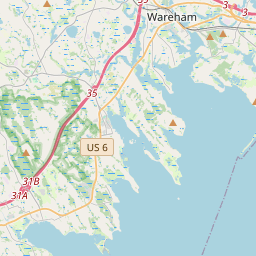
41.56989683294371
-70.7357716659779
-0.0 Amp
Downloads:
shore.nc
shore.mat
shore.kml
shore.kmz
shore.asc
shore.dir
shore.csv
shore.log
argos_24hr.kml
argos_week.kml, argos_month.kml
Elapsed time since start: 39680:52 Elapsed time since last valid data: 39678:37
MarkerMarkerMarkerMarker
Leaflet © OpenStreetMap contributors
Options for all plots below with a time axis:


Created with Highstock 6.1.3time (UTC)Depth (m)Vertical Plane22:0022:1522:3022:4523:0023:1523:3023:4511. Dec-5-2.502.557.51012.5ZoomAll1h3h6h12h1d3d1wFromDec 10, 2020ToDec 11, 2020Highcharts.com
Created with Highstock 6.1.3longitude (arcdeg)latitude (arcdeg)Navigation-70.7425-70.74-70.7375-70.735-70.7325-70.73-70.7275-70.725-70.722541.5341.53541.5441.54541.5541.55541.5641.56541.57Highcharts.com
Created with Highstock 6.1.3time (UTC)time_fix (s)latitude_fix (arcdeg)longitude_fix (arcdeg)Other22:1522:3022:4523:0023:1523:3023:4511. Dec1 607 635k1 607 637.5k1 607 640k1 607 642.5k1 607 645k1 607 647.5k41.5441.5541.5641.5741.58-70.75-70.74-70.73-70.72ZoomAll1h3h6h12h1d3d1wFromDec 10, 2020ToDec 11, 2020Highcharts.com
Created with Highstock 6.1.3time (UTC)acoustic_contact_range (m)acoustic_contact_range22:02:451101.511021102.511031103.511041104.5ZoomAll1h3h6h12h1d3d1wFromDec 10, 2020ToDec 10, 2020Highcharts.com
Created with Highstock 6.1.3time (UTC)fix_residual_percent_distance_traveled (%)fix_residual_percent_distance_traveled22:3022:4523:0023:1523:3023:4511. Dec2.533.544.555.56ZoomAll1h3h6h12h1d3d1wFromDec 10, 2020ToDec 11, 2020Highcharts.com
Created with Highstock 6.1.3time (UTC)battery_charge (Ah)battery_charge23:00322.5323323.5324324.5325ZoomAll1h3h6h12h1d3d1wFromDec 10, 2020ToDec 10, 2020Highcharts.com