Polaris 20201211T001411 Parent Directory

Open page with static plots
Start timeEnd timeLast Latitude
& Longitude
Current
(1hr avg)
2020/12/11 00:14:22 GMT
2020/12/10 16:14:22 local
2020/12/11 14:06:01 GMT
2020/12/11 06:06:01 local
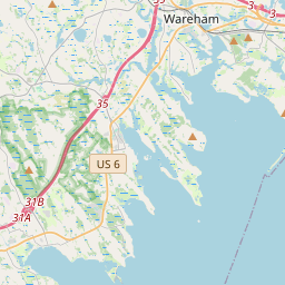
41.57032693184006
-70.69165044653592
6.11266242273787 Amp
Downloads:
shore.nc
shore.mat
shore.kml
shore.kmz
shore.asc
shore.dir
shore.csv
shore.log
argos_24hr.kml
argos_week.kml, argos_month.kml
Elapsed time since start: 39666:41 Elapsed time since last valid data: 39652:49
MarkerMarkerMarkerMarkerMarker
Leaflet © OpenStreetMap contributors
Options for all plots below with a time axis:


Created with Highstock 6.1.3time (UTC)Depth (m)Vertical Plane02:0004:0006:0008:0010:0012:0014:00-6-4-202468ZoomAll1h3h6h12h1d3d1wFromDec 11, 2020ToDec 11, 2020Highcharts.com
Created with Highstock 6.1.3longitude (arcdeg)latitude (arcdeg)Navigation-70.735-70.73-70.725-70.72-70.715-70.71-70.705-70.7-70.69541.5341.53541.5441.54541.5541.55541.5641.56541.5741.57541.58Highcharts.com
Created with Highstock 6.1.3time (UTC)time_fix (s)latitude_fix (arcdeg)longitude_fix (arcdeg)Other02:0004:0006:0008:0010:0012:0014:001 607 620k1 607 640k1 607 660k1 607 680k1 607 700k41.5241.5441.5641.58-70.74-70.72-70.7-70.68ZoomAll1h3h6h12h1d3d1wFromDec 11, 2020ToDec 11, 2020Highcharts.com
Created with Highstock 6.1.3time (UTC)fix_residual_percent_distance_traveled (%)fix_residual_percent_distance_traveled02:0004:0006:0008:0010:0012:0014:0002468101214ZoomAll1h3h6h12h1d3d1wFromDec 11, 2020ToDec 11, 2020Highcharts.com
Created with Highstock 6.1.3time (UTC)battery_charge (Ah)battery_charge02:0004:0006:0008:0010:0012:00290295300305310315320325ZoomAll1h3h6h12h1d3d1wFromDec 11, 2020ToDec 11, 2020Highcharts.com
Created with Highstock 6.1.3time (UTC)acoustic_contact_range (m)acoustic_contact_range01:52:301511.51511.7515121512.251512.51512.7515131513.25ZoomAll1h3h6h12h1d3d1wFromDec 11, 2020ToDec 11, 2020Highcharts.com