Polaris 20210403T065344 Parent Directory

Open page with static plots
Start timeEnd timeLast Latitude
& Longitude
Current
(1hr avg)
2021/04/03 06:55:46 GMT
2021/04/02 23:55:46 local
2021/04/03 20:41:08 GMT
2021/04/03 13:41:08 local
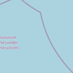
41.19618002553903
-70.88030458613689
1.8082473292156083 Amp
Downloads:
shore.nc
shore.mat
shore.kml
shore.kmz
shore.asc
shore.dir
shore.csv
shore.log
argos_24hr.kml
argos_week.kml, argos_month.kml
Elapsed time since start: 36994:46 Elapsed time since last valid data: 36981:01
MarkerMarker
Leaflet © OpenStreetMap contributors
Options for all plots below with a time axis:


Created with Highstock 6.1.3time (UTC)Depth (m)Vertical Plane08:0010:0012:0014:0016:0018:0020:00-100102030405060ZoomAll1h3h6h12h1d3d1wFromApr 3, 2021ToApr 3, 2021Highcharts.com
Created with Highstock 6.1.3time (UTC)chlorophyll (ug/l)Science08:0010:0012:0014:0016:0018:0020:000123456ZoomAll1h3h6h12h1d3d1wFromApr 3, 2021ToApr 3, 2021Highcharts.com
Created with Highstock 6.1.3time (UTC)Depth (m)bin_median_temperature (degC)bin_median_salinity (psu)chlorophyll (ug/l)Science Sections08:0010:0012:0014:0016:0018:0020:00-2502550754.555.563232.2532.532.750246ZoomAll1h3h6h12h1d3d1wFromApr 3, 2021ToApr 3, 2021Highcharts.com
Created with Highstock 6.1.3degC5.842 -5.794 -5.746 -5.699 -5.651 -5.604 -5.556 -5.508 -5.461 -5.413 -5.365 -5.318 -5.270 -5.223 -5.175 -5.127 -5.080 -5.032 -4.985 -4.937 -time (UTC)Depth (m)Science Section: CTD_Seabird.bin_median_temperature08:0010:0012:0014:0016:0018:0020:00-100102030405060ZoomAll1h3h6h12h1d3d1wFromApr 3, 2021ToApr 3, 2021Highcharts.com
Created with Highstock 6.1.3psu32.645 -32.615 -32.585 -32.555 -32.525 -32.495 -32.465 -32.435 -32.405 -32.375 -32.345 -32.315 -32.285 -32.255 -32.225 -32.195 -32.165 -32.135 -32.105 -32.075 -time (UTC)Depth (m)Science Section: CTD_Seabird.bin_median_salinity08:0010:0012:0014:0016:0018:0020:00-100102030405060ZoomAll1h3h6h12h1d3d1wFromApr 3, 2021ToApr 3, 2021Highcharts.com
Created with Highstock 6.1.3ug/l4.743 -4.526 -4.310 -4.094 -3.877 -3.661 -3.444 -3.228 -3.011 -2.795 -2.578 -2.362 -2.145 -1.929 -1.712 -1.496 -1.279 -1.063 -0.846 -0.630 -time (UTC)Depth (m)Science Section: chlorophyll08:0010:0012:0014:0016:0018:0020:00-100102030405060ZoomAll1h3h6h12h1d3d1wFromApr 3, 2021ToApr 3, 2021Highcharts.com
Created with Highstock 6.1.3time (UTC)bin_median_salinity (psu)bin_median_temperature (degC)CTD_Seabird08:0010:0012:0014:0016:0018:0020:003232.232.432.632.84.7555.255.55.756ZoomAll1h3h6h12h1d3d1wFromApr 3, 2021ToApr 3, 2021Highcharts.com
Created with Highstock 6.1.3longitude (arcdeg)latitude (arcdeg)Navigation-70.887-70.886-70.885-70.884-70.883-70.882-70.88140.840.8540.940.954141.0541.141.1541.241.2540.75Highcharts.com
Created with Highstock 6.1.3time (UTC)time_fix (s)latitude_fix (arcdeg)longitude_fix (arcdeg)Other08:0010:0012:0014:0016:0018:0020:001 617 420k1 617 440k1 617 460k1 617 480k1 617 500k40.840.94141.141.241.3-70.8875-70.885-70.8825-70.88-70.8775ZoomAll1h3h6h12h1d3d1wFromApr 3, 2021ToApr 3, 2021Highcharts.com
Created with Highstock 6.1.3time (UTC)fix_residual_percent_distance_traveled (%)fix_residual_percent_distance_traveled08:0010:0012:0014:0016:0018:0020:002345678ZoomAll1h3h6h12h1d3d1wFromApr 3, 2021ToApr 3, 2021Highcharts.com
Created with Highstock 6.1.3time (UTC)battery_charge (Ah)battery_charge10:0012:0014:0016:0018:0020:00250252.5255257.5260262.5265267.5270ZoomAll1h3h6h12h1d3d1wFromApr 3, 2021ToApr 3, 2021Highcharts.com