Polaris 20210415T134220 Parent Directory

Open page with static plots
Start timeEnd timeLast Latitude
& Longitude
Current
(1hr avg)
2021/04/15 13:46:41 GMT
2021/04/15 06:46:41 local
2021/04/15 14:47:28 GMT
2021/04/15 07:47:28 local
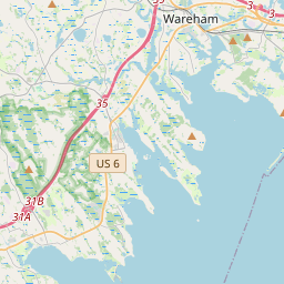
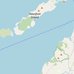
41.55091817599798
-70.70629860429908
-0.0 Amp
Downloads:
shore.nc
shore.mat
shore.kml
shore.kmz
shore.asc
shore.dir
shore.csv
shore.log
argos_24hr.kml
argos_week.kml, argos_month.kml
Elapsed time since start: 36755:23 Elapsed time since last valid data: 36754:22
MarkerMarkerMarker
Leaflet © OpenStreetMap contributors
Options for all plots below with a time axis:


Created with Highstock 6.1.3time (UTC)chlorophyll (ug/l)Science14:0514:1014:1514:2014:2514:300.470.480.490.50.510.520.530.540.550.56ZoomAll1h3h6h12h1d3d1wFromApr 15, 2021ToApr 15, 2021Highcharts.com
Created with Highstock 6.1.3time (UTC)Depth (m)Vertical Plane13:5014:0014:1014:2014:3014:40-6-4-202468ZoomAll1h3h6h12h1d3d1wFromApr 15, 2021ToApr 15, 2021Highcharts.com
Created with Highstock 6.1.3time (UTC)Depth (m)bin_median_temperature (degC)bin_median_salinity (psu)chlorophyll (ug/l)Science Sections13:5014:0014:1014:2014:3014:40-505108.18.28.38.431.57531.631.62531.6531.6750.450.4750.50.5250.550.575ZoomAll1h3h6h12h1d3d1wFromApr 15, 2021ToApr 15, 2021Highcharts.com
Created with Highstock 6.1.3degC8.350 -8.339 -8.329 -8.318 -8.308 -8.297 -8.287 -8.276 -8.266 -8.255 -8.245 -8.234 -8.224 -8.213 -8.203 -8.192 -8.182 -8.171 -8.161 -8.150 -time (UTC)Depth (m)Science Section: CTD_Seabird.bin_median_temperature13:5014:0014:1014:2014:3014:40-6-4-202468ZoomAll1h3h6h12h1d3d1wFromApr 15, 2021ToApr 15, 2021Highcharts.com
Created with Highstock 6.1.3psu31.663 -31.659 -31.656 -31.652 -31.649 -31.646 -31.642 -31.639 -31.635 -31.632 -31.628 -31.625 -31.622 -31.618 -31.615 -31.611 -31.608 -31.605 -31.601 -31.598 -time (UTC)Depth (m)Science Section: CTD_Seabird.bin_median_salinity13:5014:0014:1014:2014:3014:40-6-4-202468ZoomAll1h3h6h12h1d3d1wFromApr 15, 2021ToApr 15, 2021Highcharts.com
Created with Highstock 6.1.3ug/l0.549 -0.545 -0.542 -0.538 -0.534 -0.531 -0.527 -0.523 -0.520 -0.516 -0.512 -0.509 -0.505 -0.501 -0.498 -0.494 -0.490 -0.487 -0.483 -0.479 -time (UTC)Depth (m)Science Section: chlorophyll13:5014:0014:1014:2014:3014:40-6-4-202468ZoomAll1h3h6h12h1d3d1wFromApr 15, 2021ToApr 15, 2021Highcharts.com
Created with Highstock 6.1.3time (UTC)bin_median_temperature (degC)bin_median_salinity (psu)CTD_Seabird14:0514:1014:1514:2014:2514:308.18.158.28.258.38.358.431.5831.631.6231.6431.6631.68ZoomAll1h3h6h12h1d3d1wFromApr 15, 2021ToApr 15, 2021Highcharts.com
Created with Highstock 6.1.3longitude (arcdeg)latitude (arcdeg)Navigation-70.705-70.7025-70.7-70.6975-70.695-70.6925-70.6941.54641.546541.54741.547541.54841.548541.54941.549541.5541.550541.55141.5515Highcharts.com
Created with Highstock 6.1.3time (UTC)time_fix (s)latitude_fix (arcdeg)longitude_fix (arcdeg)Other13:5014:0014:1014:2014:3014:401 618 494k1 618 495k1 618 496k1 618 497k1 618 498k41.54641.54841.5541.552-70.71-70.705-70.7-70.695-70.69-70.685ZoomAll1h3h6h12h1d3d1wFromApr 15, 2021ToApr 15, 2021Highcharts.com
Created with Highstock 6.1.3time (UTC)fix_residual_percent_distance_traveled (%)fix_residual_percent_distance_traveled14:34:33.1360.208318ZoomAll1h3h6h12h1d3d1wFromApr 15, 2021ToApr 15, 2021Highcharts.com
Created with Highstock 6.1.3time (UTC)battery_charge (Ah)battery_charge14:14:19.866275.617767ZoomAll1h3h6h12h1d3d1wFromApr 15, 2021ToApr 15, 2021Highcharts.com