Parent Directory
Parent Directory
Parent Directory
| Start time | End time | Last Latitude & Longitude |
Current (1hr avg) |
|---|---|---|---|
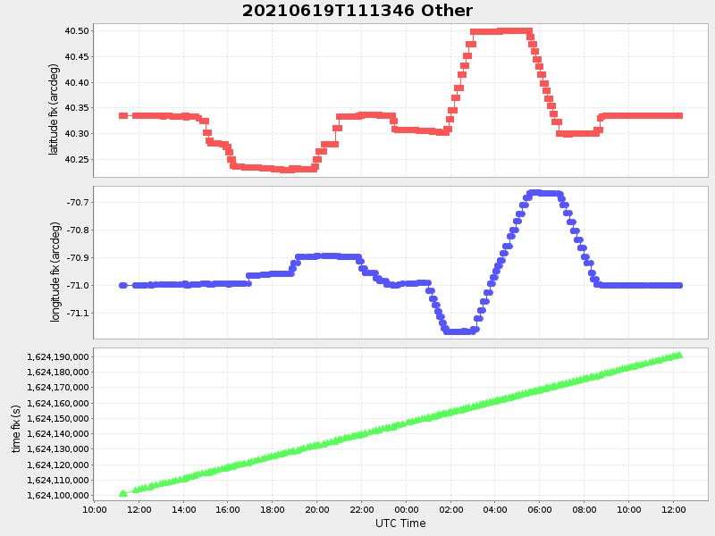
| 2021/06/19 11:14:07 GMT 2021/06/19 04:14:07 local |
2021/06/20 12:17:54 GMT 2021/06/20 05:17:54 local |
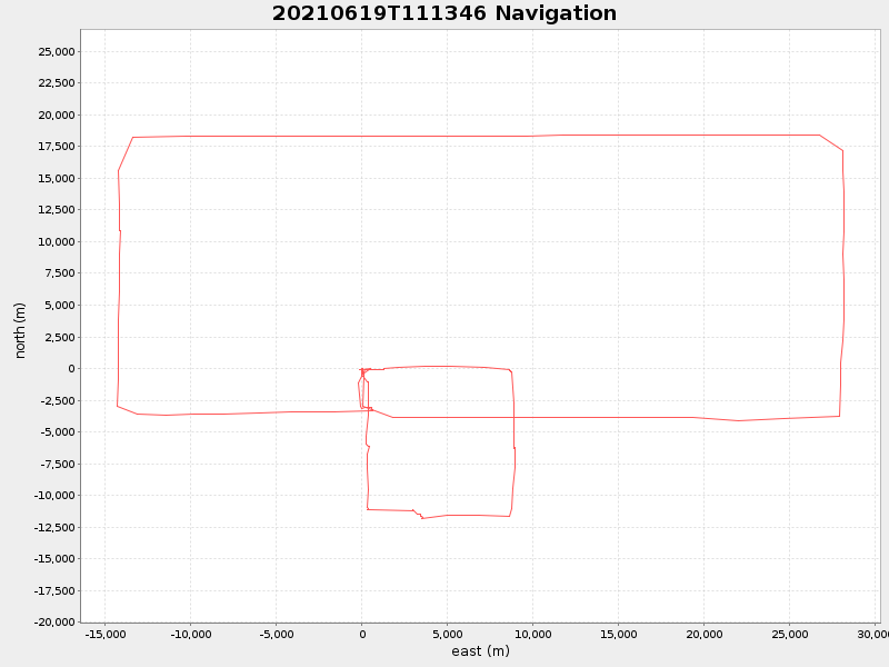
40.33435016657571 -71.00067366605177 |
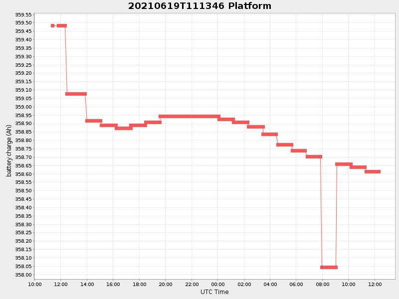
0.02494162926294251 Amp |
| Downloads: | ||||
| shore.nc shore.mat |
shore.kml shore.kmz |
shore.asc shore.dir |
shore.csv shore.log |
argos_24hr.kml argos_week.kml, argos_month.kml |
| Elapsed time since start: ... | Elapsed time since last valid data: ... |