Parent Directory
Parent Directory
Parent Directory
| Start time | End time | Last Latitude & Longitude |
Current (1hr avg) |
|---|---|---|---|
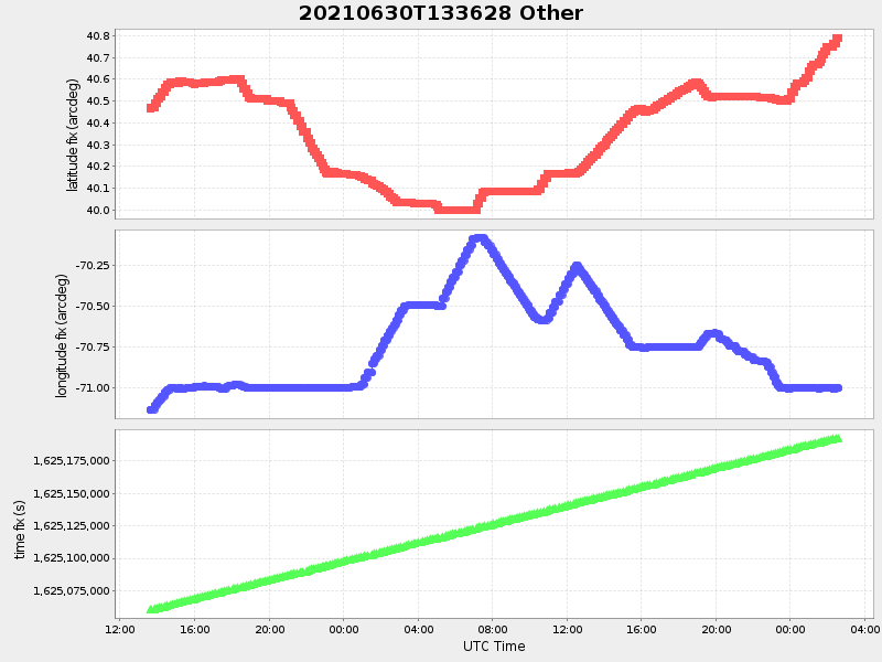
| 2021/06/30 13:36:41 GMT 2021/06/30 06:36:41 local |
2021/07/02 02:36:19 GMT 2021/07/01 19:36:19 local |
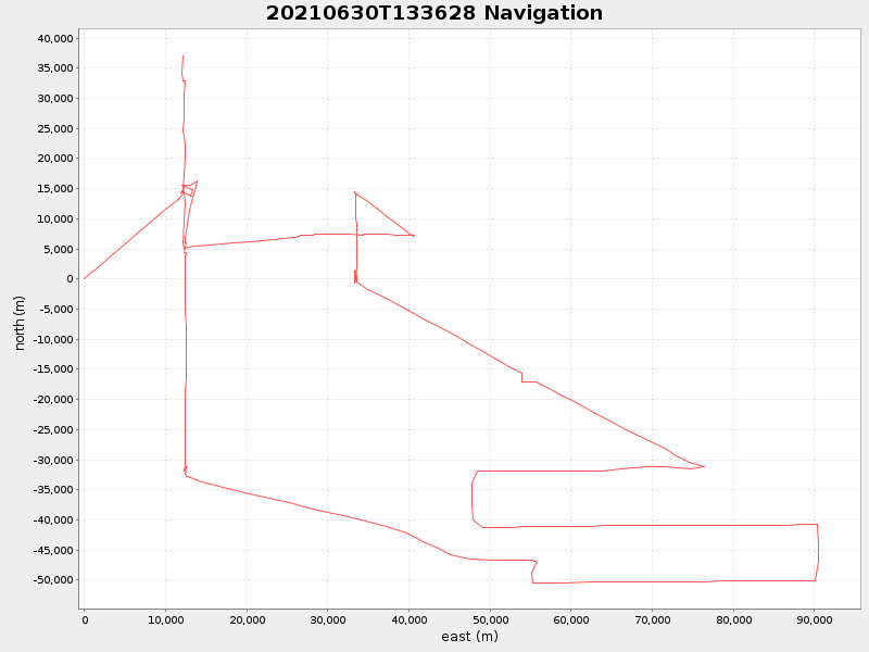
40.788363833042155 -71.00082366591053 |
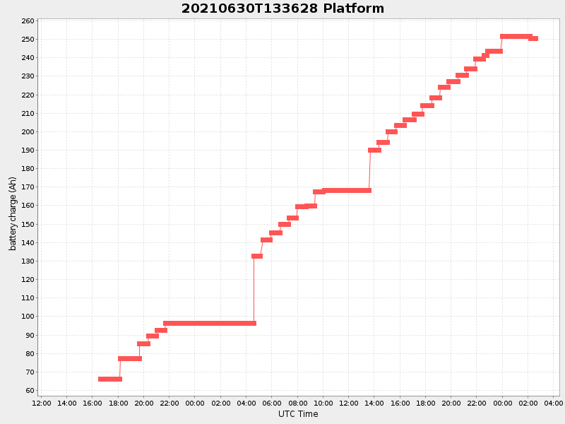
0.9568337611090443 Amp |
| Downloads: | ||||
| shore.nc shore.mat |
shore.kml shore.kmz |
shore.asc shore.dir |
shore.csv shore.log |
argos_24hr.kml argos_week.kml, argos_month.kml |
| Elapsed time since start: ... | Elapsed time since last valid data: ... |