Parent Directory
Parent Directory
Parent Directory
| Start time | End time | Last Latitude & Longitude |
Current (1hr avg) |
|---|---|---|---|
| 2021/07/25 17:50:31 GMT 2021/07/25 10:50:31 local |
2021/07/28 16:33:42 GMT 2021/07/28 09:33:42 local |
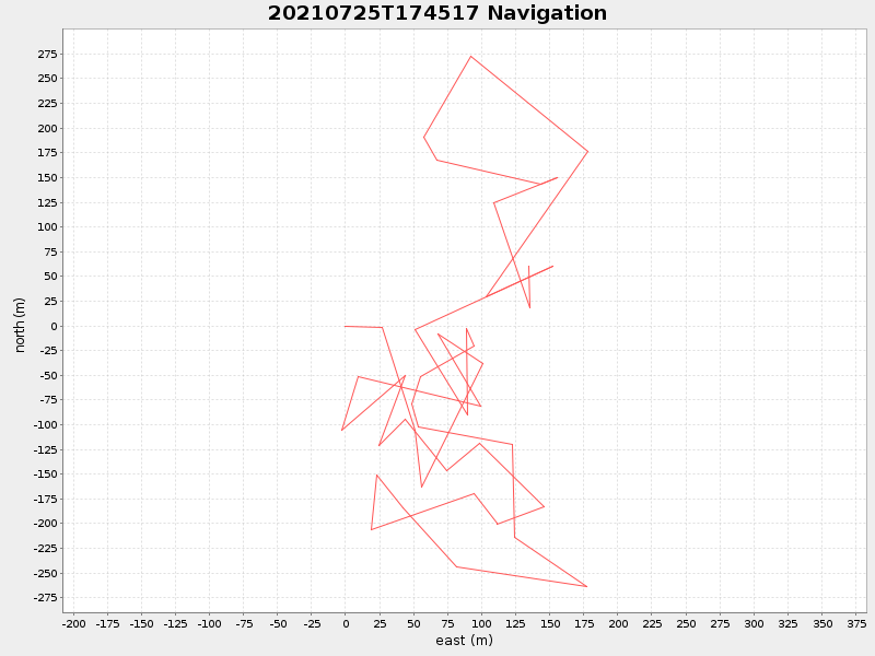
41.52191433755959 -70.67265340427508 |
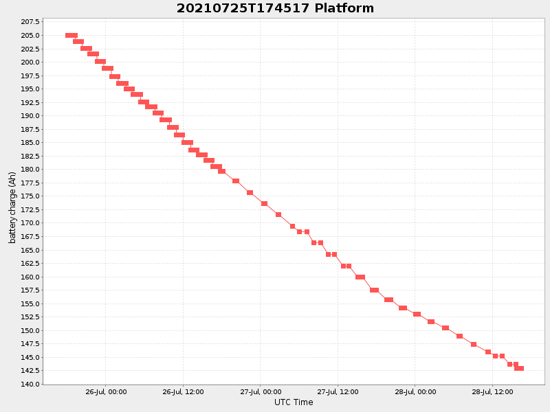
0.41578012261766 Amp |
| Downloads: | ||||
| shore.nc shore.mat |
shore.kml shore.kmz |
shore.asc shore.dir |
shore.csv shore.log |
argos_24hr.kml argos_week.kml, argos_month.kml |
| Elapsed time since start: ... | Elapsed time since last valid data: ... |