Parent Directory
Parent Directory
Parent Directory
| Start time | End time | Last Latitude & Longitude |
Current (1hr avg) |
|---|---|---|---|
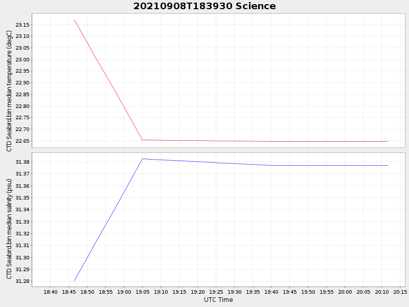
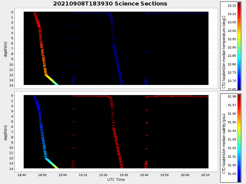
| 2021/09/08 18:39:41 GMT 2021/09/08 11:39:41 local |
2021/09/08 20:11:40 GMT 2021/09/08 13:11:40 local |
41.550337616588635 -70.68500467414103 |
-0.008209694481293025 Amp |
| Downloads: | ||||
| shore.nc shore.mat |
shore.kml shore.kmz |
shore.asc shore.dir |
shore.csv shore.log |
argos_24hr.kml argos_week.kml, argos_month.kml |
| Elapsed time since start: ... | Elapsed time since last valid data: ... |