Parent Directory
Parent Directory
Parent Directory
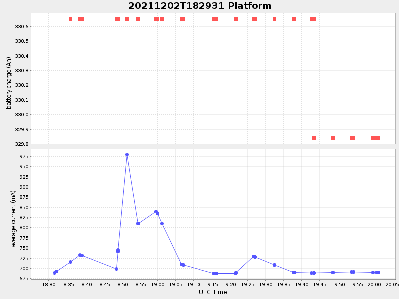
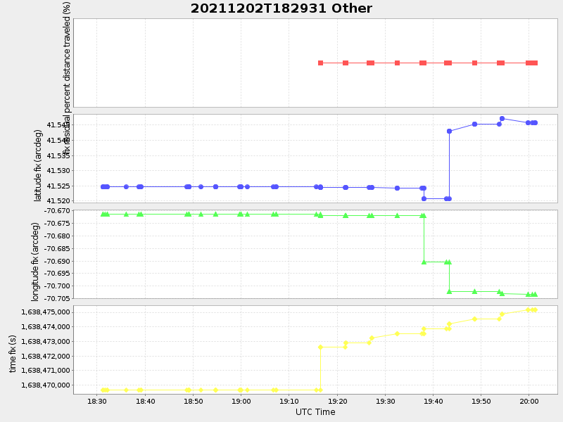
| Start time | End time | Last Latitude & Longitude |
Current (1hr avg) |
|---|---|---|---|
| 2021/12/02 18:29:44 GMT 2021/12/02 10:29:44 local |
2021/12/02 20:01:17 GMT 2021/12/02 12:01:17 local |
41.54589251538619 -70.70325192888393 |
0.7918883337950937 Amp |
| Downloads: | ||||
| shore.nc shore.mat |
shore.kml shore.kmz |
shore.asc shore.dir |
shore.csv shore.log |
argos_24hr.kml argos_week.kml, argos_month.kml |
| Elapsed time since start: ... | Elapsed time since last valid data: ... |