Parent Directory
Parent Directory
Parent Directory
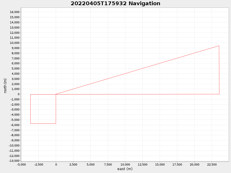
| Start time | End time | Last Latitude & Longitude |
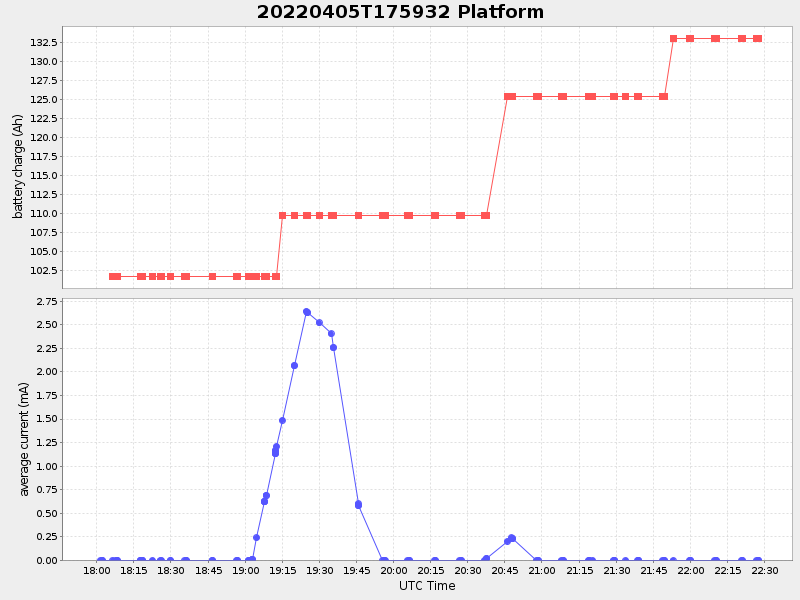
Current (1hr avg) |
|---|---|---|---|
| 2022/04/05 17:59:44 GMT 2022/04/05 10:59:44 local |
2022/04/05 22:27:43 GMT 2022/04/05 15:27:43 local |
41.45000076280542 -71.0130004874757 |
-6.742536769567218 Amp |
| Downloads: | ||||
| shore.nc shore.mat |
shore.kml shore.kmz |
shore.asc shore.dir |
shore.csv shore.log |
argos_24hr.kml argos_week.kml, argos_month.kml |
| Elapsed time since start: ... | Elapsed time since last valid data: ... |