Parent Directory
Parent Directory
Parent Directory
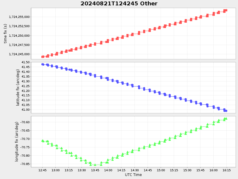
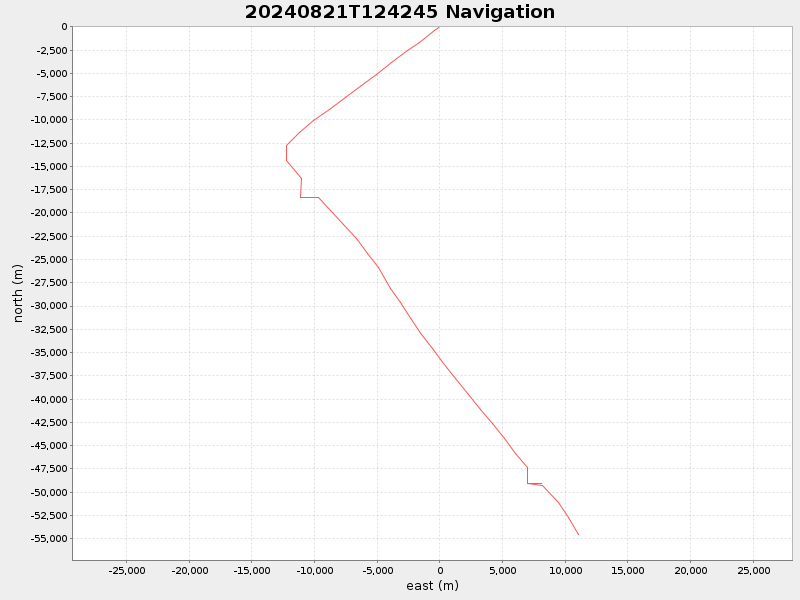
| Start time | End time | Last Latitude & Longitude |
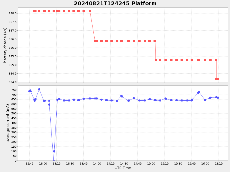
Current (1hr avg) |
|---|---|---|---|
| 2024/08/21 12:43:00 GMT 2024/08/21 05:43:00 local |
2024/08/21 16:14:35 GMT 2024/08/21 09:14:35 local |
40.988053166274874 -70.57712216637096 |
1.0442666105963638 Amp |
| Downloads: | ||||
| shore.nc shore.mat |
shore.kml shore.kmz |
shore.asc shore.dir |
shore.csv shore.log |
argos_24hr.kml argos_week.kml, argos_month.kml |
| Elapsed time since start: ... | Elapsed time since last valid data: ... |