Parent Directory
Parent Directory
Parent Directory
| Start time | End time | Last Latitude & Longitude |
Current (1hr avg) |
|---|---|---|---|
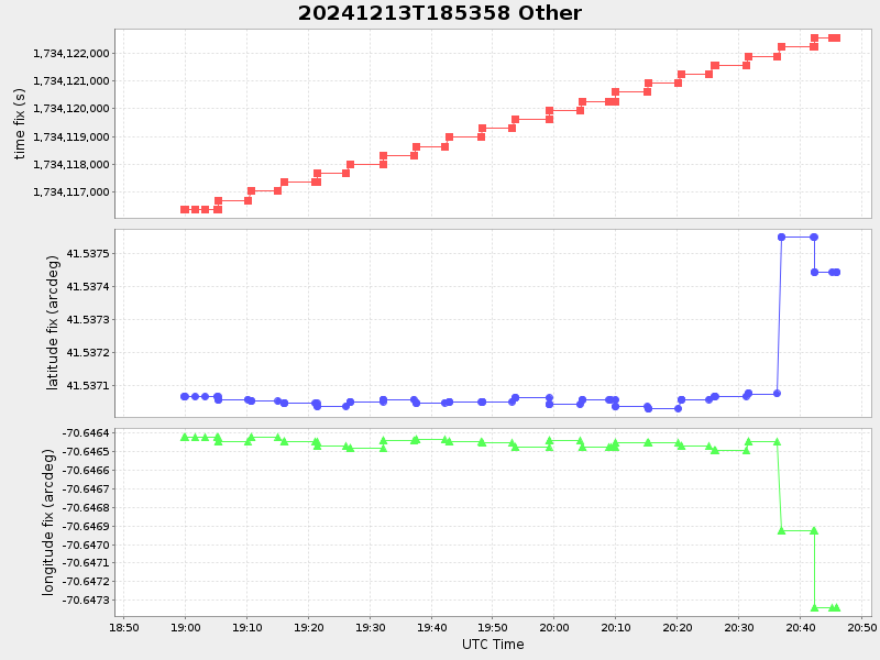
| 2024/12/13 18:54:13 GMT 2024/12/13 10:54:13 local |
2024/12/13 20:45:57 GMT 2024/12/13 12:45:57 local |
41.53744516637213 -70.6473406665151 |
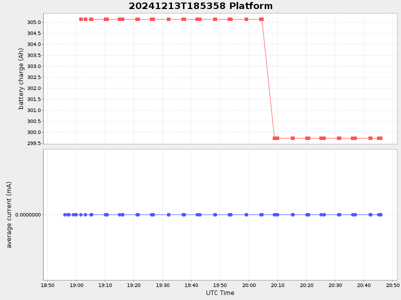
5.137776233381482 Amp |
| Downloads: | ||||
| shore.nc shore.mat |
shore.kml shore.kmz |
shore.asc shore.dir |
shore.csv shore.log |
argos_24hr.kml argos_week.kml, argos_month.kml |
| Elapsed time since start: ... | Elapsed time since last valid data: ... |