Parent Directory
Parent Directory
Parent Directory
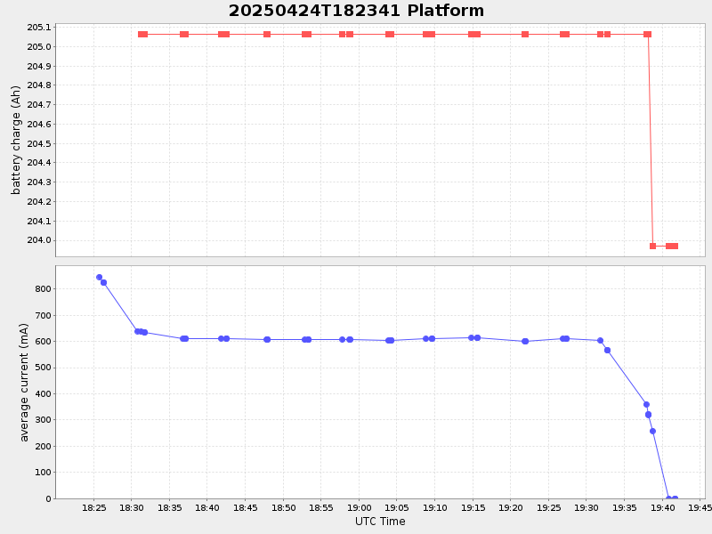
| Start time | End time | Last Latitude & Longitude |
Current (1hr avg) |
|---|---|---|---|
| 2025/04/24 18:23:57 GMT 2025/04/24 11:23:57 local |
2025/04/24 19:41:43 GMT 2025/04/24 12:41:43 local |
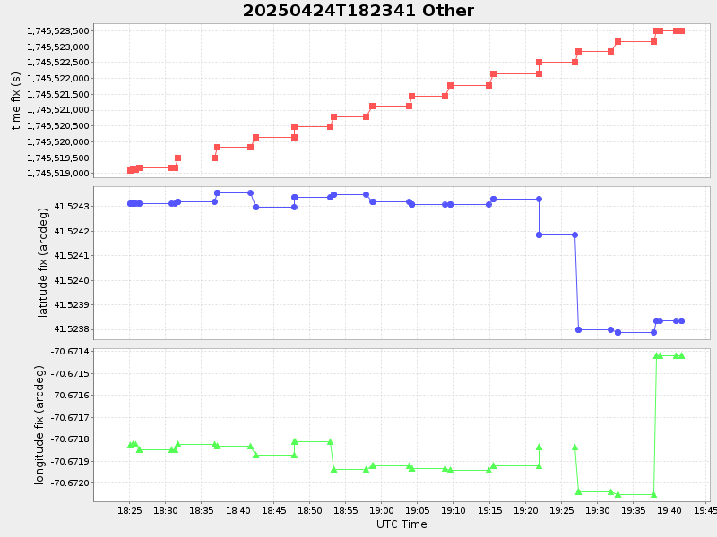
41.52383333306802 -70.67141783289263 |
1.0160667588728494 Amp |
| Downloads: | ||||
| shore.nc shore.mat |
shore.kml shore.kmz |
shore.asc shore.dir |
shore.csv shore.log |
argos_24hr.kml argos_week.kml, argos_month.kml |
| Elapsed time since start: ... | Elapsed time since last valid data: ... |