Parent Directory
Parent Directory
Parent Directory
| Start time | End time | Last Latitude & Longitude |
Current (1hr avg) |
|---|---|---|---|
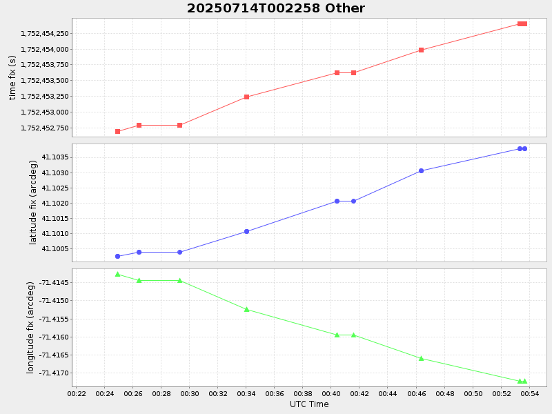
| 2025/07/14 00:23:15 GMT 2025/07/13 17:23:15 local |
2025/07/14 00:53:41 GMT 2025/07/13 17:53:41 local |
41.103775833249024 -71.41722516648716 |
-0.0 Amp |
| Downloads: | ||||
| shore.nc shore.mat |
shore.kml shore.kmz |
shore.asc shore.dir |
shore.csv shore.log |
argos_24hr.kml argos_week.kml, argos_month.kml |
| Elapsed time since start: ... | Elapsed time since last valid data: ... |