Parent Directory
Parent Directory
Parent Directory
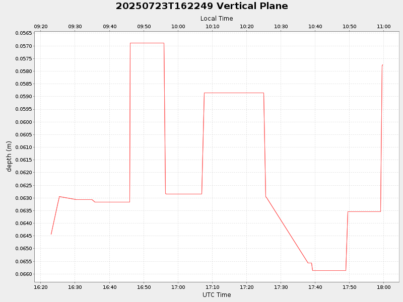
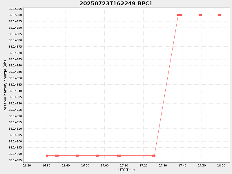
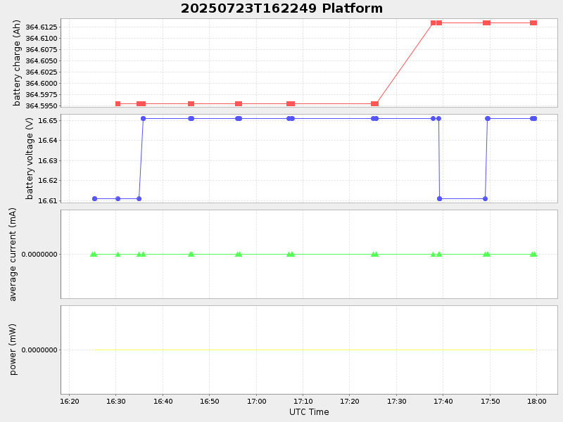
| Start time | End time | Last Latitude & Longitude |
Current (1hr avg) |
|---|---|---|---|
| 2025/07/23 16:23:05 GMT 2025/07/23 09:23:05 local |
2025/07/23 17:59:37 GMT 2025/07/23 10:59:37 local |
NaN NaN |
-0.01690165177765147 Amp |
| Downloads: | ||||
| shore.nc shore.mat |
shore.kml shore.kmz |
shore.asc shore.dir |
shore.csv shore.log |
argos_24hr.kml argos_week.kml, argos_month.kml |
| Elapsed time since start: ... | Elapsed time since last valid data: ... |