Parent Directory
Parent Directory
Parent Directory
| Start time | End time | Last Latitude & Longitude |
Current (1hr avg) |
|---|---|---|---|
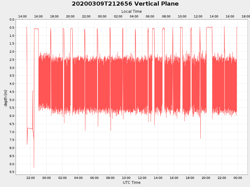
| 2020/03/09 21:30:29 GMT 2020/03/09 14:30:29 local |
2020/03/10 23:54:29 GMT 2020/03/10 16:54:29 local |
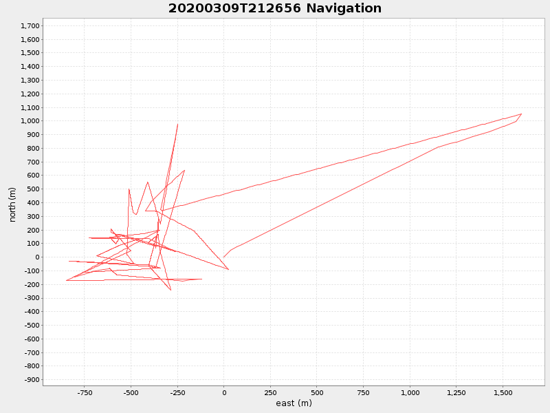
41.55004044249502 -70.697335236661 |
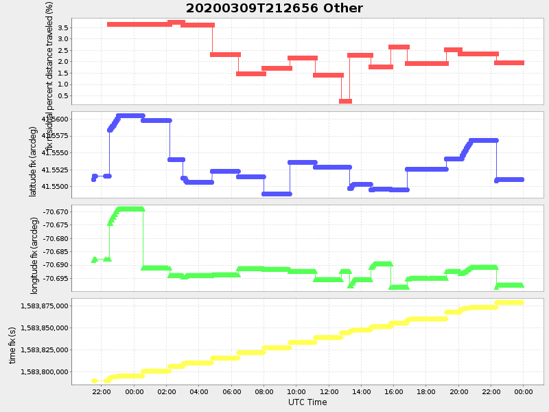
5.900028966827956 Amp |
| Downloads: | ||||
| shore.nc shore.mat |
shore.kml shore.kmz |
shore.asc shore.dir |
shore.csv shore.log |
argos_24hr.kml argos_week.kml, argos_month.kml |
| Elapsed time since start: ... | Elapsed time since last valid data: ... |