Parent Directory
Parent Directory
Parent Directory
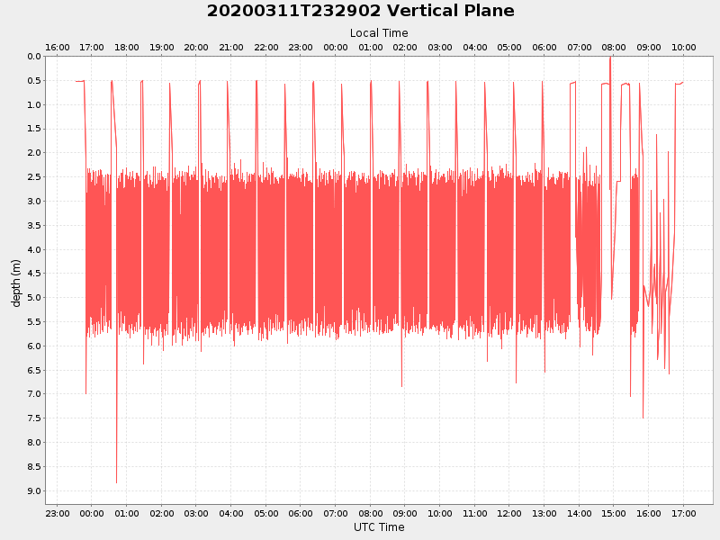
| Start time | End time | Last Latitude & Longitude |
Current (1hr avg) |
|---|---|---|---|
| 2020/03/11 23:33:05 GMT 2020/03/11 16:33:05 local |
2020/03/12 16:58:41 GMT 2020/03/12 09:58:41 local |
41.55443280775018 -70.69522570455464 |
4.3363551559042675 Amp |
| Downloads: | ||||
| shore.nc shore.mat |
shore.kml shore.kmz |
shore.asc shore.dir |
shore.csv shore.log |
argos_24hr.kml argos_week.kml, argos_month.kml |
| Elapsed time since start: ... | Elapsed time since last valid data: ... |