Polaris 20200312T165841 Parent Directory

Open page with static plots
Start timeEnd timeLast Latitude
& Longitude
Current
(1hr avg)
2020/03/12 16:59:24 GMT
2020/03/12 09:59:24 local
2020/03/12 17:24:41 GMT
2020/03/12 10:24:41 local
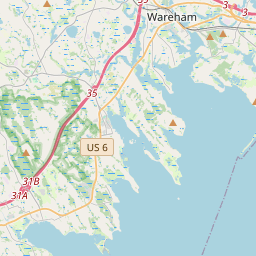
41.55489878431622
-70.6945631570286
-0.0 Amp
Downloads:
shore.nc
shore.mat
shore.kml
shore.kmz
shore.asc
shore.dir
shore.csv
shore.log
argos_24hr.kml
argos_week.kml, argos_month.kml
Elapsed time since start: 46228:54 Elapsed time since last valid data: 46228:29
MarkerMarkerMarker
Leaflet © OpenStreetMap contributors
Options for all plots below with a time axis:


Created with Highstock 6.1.3time (UTC)Depth (m)Vertical Plane17:0017:0217:0417:0617:0817:1017:1217:1417:1617:1817:2017:2217:24-6-4-20246ZoomAll1h3h6h12h1d3d1wFromMar 12, 2020ToMar 12, 2020Highcharts.com
Created with Highstock 6.1.3longitude (arcdeg)latitude (arcdeg)Navigation-70.69575-70.6955-70.69525-70.695-70.69475-70.6945-70.6942541.55441.554141.554241.554341.554441.554541.554641.554741.554841.554941.55541.555141.5552Highcharts.com
Created with Highstock 6.1.3time (UTC)time_fix (s)latitude_fix (arcdeg)longitude_fix (arcdeg)Other17:0017:151 584 032 0001 584 032 5001 584 033 0001 584 033 5001 584 034 00041.5542541.554541.5547541.55541.55525-70.6955-70.695-70.6945-70.694ZoomAll1h3h6h12h1d3d1wFromMar 12, 2020ToMar 12, 2020Highcharts.com
Created with Highstock 6.1.3time (UTC)battery_voltage (V)battery_voltage17:0017:1017:2017:0517:1513.913.951414.0514.114.1514.2ZoomAll1h3h6h12h1d3d1wFromMar 12, 2020ToMar 12, 2020Highcharts.com
Created with Highstock 6.1.3time (UTC)battery_charge (Ah)battery_charge17:20:47.66490.800003ZoomAll1h3h6h12h1d3d1wFromMar 12, 2020ToMar 12, 2020Highcharts.com
Created with Highstock 6.1.3time (UTC)acoustic_contact_range (m)DUSBL_Hydroid17:0617:0817:1017:1217:1417:160255075100125150175200ZoomAll1h3h6h12h1d3d1wFromMar 12, 2020ToMar 12, 2020Highcharts.com