Parent Directory
Parent Directory
Parent Directory
| Start time | End time | Last Latitude & Longitude |
Current (1hr avg) |
|---|---|---|---|
| 2020/03/20 16:59:17 GMT 2020/03/20 09:59:17 local |
2020/03/20 19:40:44 GMT 2020/03/20 12:40:44 local |
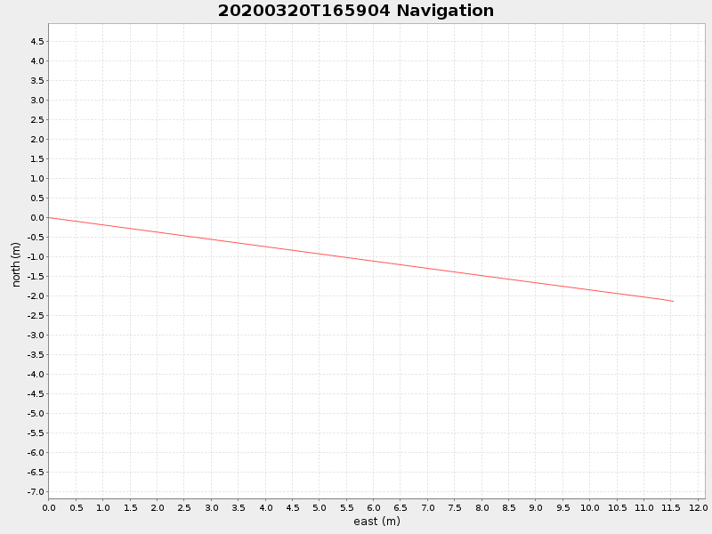
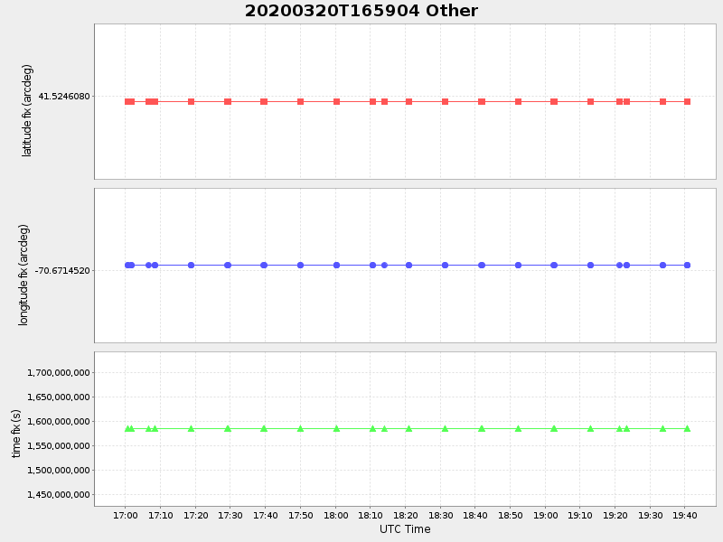
41.52458881810765 -70.67131323644956 |
0.061616698468998726 Amp |
| Downloads: | ||||
| shore.nc shore.mat |
shore.kml shore.kmz |
shore.asc shore.dir |
shore.csv shore.log |
argos_24hr.kml argos_week.kml, argos_month.kml |
| Elapsed time since start: 46032:43 | Elapsed time since last valid data: 46030:01 |