Parent Directory
Parent Directory
Parent Directory
| Start time | End time | Last Latitude & Longitude |
Current (1hr avg) |
|---|---|---|---|
| 2020/06/02 20:19:08 GMT 2020/06/02 13:19:08 local |
2020/06/03 12:17:34 GMT 2020/06/03 05:17:34 local |
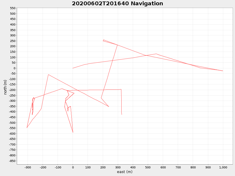
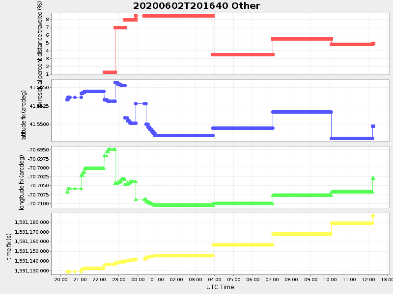
41.54951237140524 -70.70288987382953 |
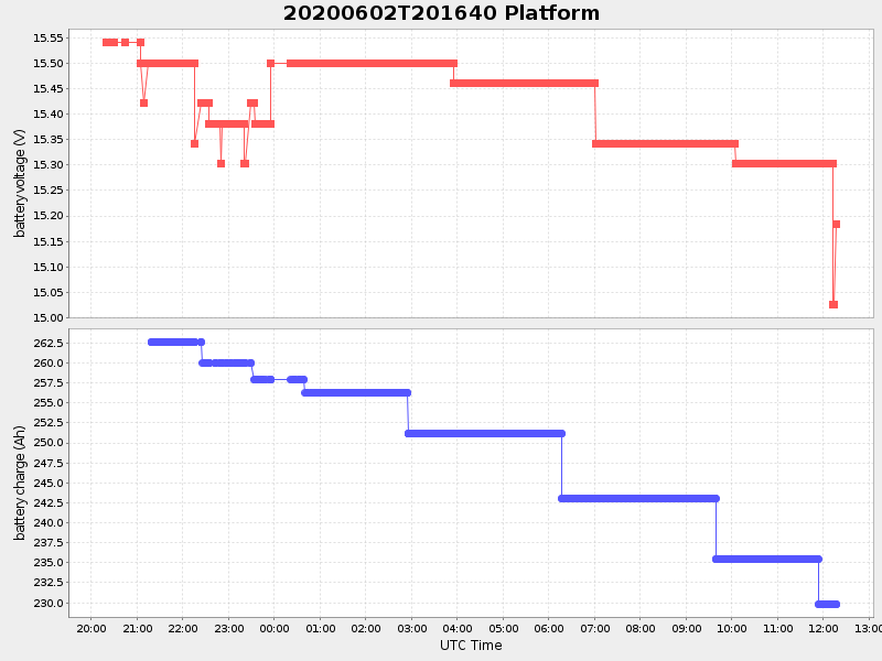
5.635163965879894 Amp |
| Downloads: | ||||
| shore.nc shore.mat |
shore.kml shore.kmz |
shore.asc shore.dir |
shore.csv shore.log |
argos_24hr.kml argos_week.kml, argos_month.kml |
| Elapsed time since start: ... | Elapsed time since last valid data: ... |