Polaris 20200603T143145 Parent Directory

Open page with static plots
Start timeEnd timeLast Latitude
& Longitude
Current
(1hr avg)
2020/06/03 14:31:59 GMT
2020/06/03 07:31:59 local
2020/06/03 17:03:12 GMT
2020/06/03 10:03:12 local
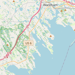
41.55589327761854
-70.71016897451472
2.283362853321351 Amp
Downloads:
shore.nc
shore.mat
shore.kml
shore.kmz
shore.asc
shore.dir
shore.csv
shore.log
argos_24hr.kml
argos_week.kml, argos_month.kml
Elapsed time since start: 44284:15 Elapsed time since last valid data: 44281:44
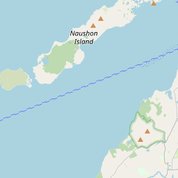
MarkerMarkerMarkerMarker
Leaflet © OpenStreetMap contributors
Options for all plots below with a time axis:


Created with Highstock 6.1.3time (UTC)Depth (m)Vertical Plane14:4515:0015:1515:3015:4516:0016:1516:3016:4517:00-5-2.502.557.510ZoomAll1h3h6h12h1d3d1wFromJun 3, 2020ToJun 3, 2020Highcharts.com
Created with Highstock 6.1.3longitude (arcdeg)latitude (arcdeg)Navigation-70.71-70.7095-70.709-70.7085-70.708-70.7075-70.70741.54741.54841.54941.5541.55141.55241.55341.55441.55541.55641.55741.546Highcharts.com
Created with Highstock 6.1.3time (UTC)time_fix (s)latitude_fix (arcdeg)longitude_fix (arcdeg)Other14:4515:0015:1515:3015:4516:0016:1516:3016:451 591 192.5k1 591 195k1 591 197.5k1 591 200k1 591 202.5k1 591 205k41.55241.55341.55441.55541.556-70.711-70.71-70.709-70.708ZoomAll1h3h6h12h1d3d1wFromJun 3, 2020ToJun 3, 2020Highcharts.com
Created with Highstock 6.1.3time (UTC)battery_voltage (V)battery_voltage14:4515:0015:1515:3015:4516:0016:1516:3016:4517:0014.9751515.02515.0515.07515.115.12515.1515.175ZoomAll1h3h6h12h1d3d1wFromJun 3, 2020ToJun 3, 2020Highcharts.com
Created with Highstock 6.1.3time (UTC)battery_charge (Ah)battery_charge15:0016:00217218219220221222223224ZoomAll1h3h6h12h1d3d1wFromJun 3, 2020ToJun 3, 2020Highcharts.com
Created with Highstock 6.1.3time (UTC)fix_residual_percent_distance_traveled (%)fix_residual_percent_distance_traveled16:59:57.1800.92907ZoomAll1h3h6h12h1d3d1wFromJun 3, 2020ToJun 3, 2020Highcharts.com