Parent Directory
Parent Directory
Parent Directory
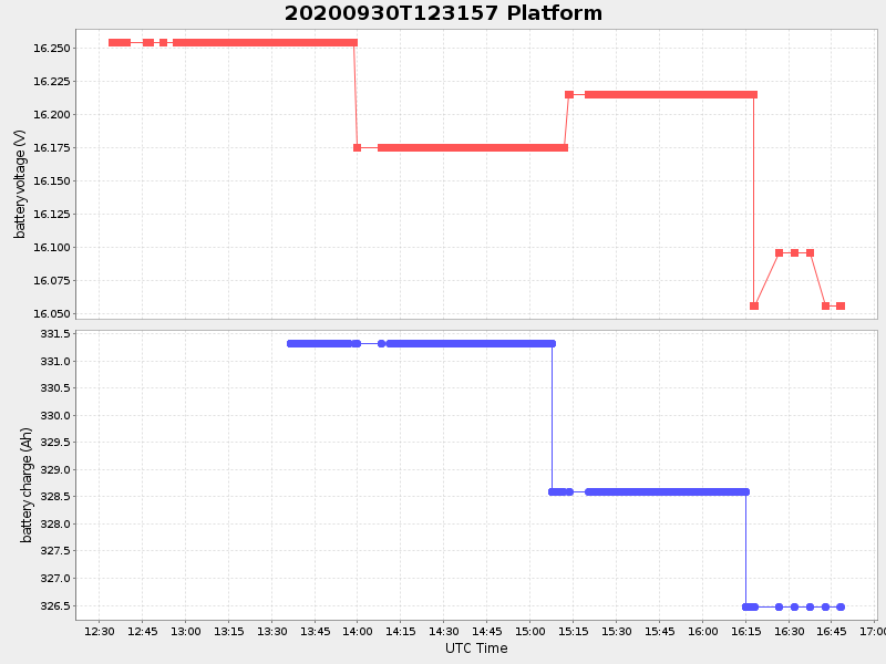
| Start time | End time | Last Latitude & Longitude |
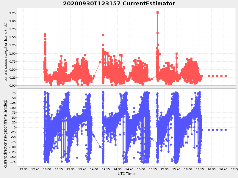
Current (1hr avg) |
|---|---|---|---|
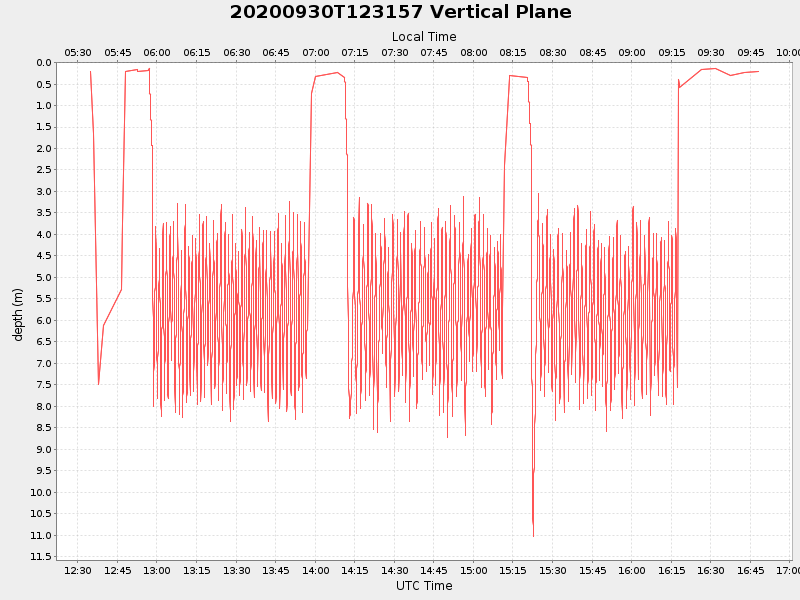
| 2020/09/30 12:34:45 GMT 2020/09/30 05:34:45 local |
2020/09/30 16:48:08 GMT 2020/09/30 09:48:08 local |
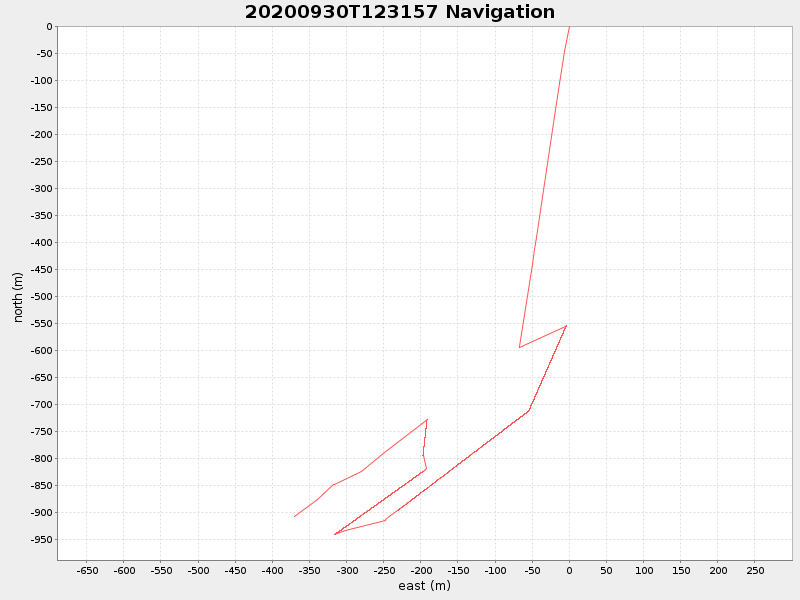
41.54914104031696 -70.71003790275098 |
2.12427787122055 Amp |
| Downloads: | ||||
| shore.nc shore.mat |
shore.kml shore.kmz |
shore.asc shore.dir |
shore.csv shore.log |
argos_24hr.kml argos_week.kml, argos_month.kml |
| Elapsed time since start: ... | Elapsed time since last valid data: ... |