Parent Directory
Parent Directory
Parent Directory
| Start time | End time | Last Latitude & Longitude |
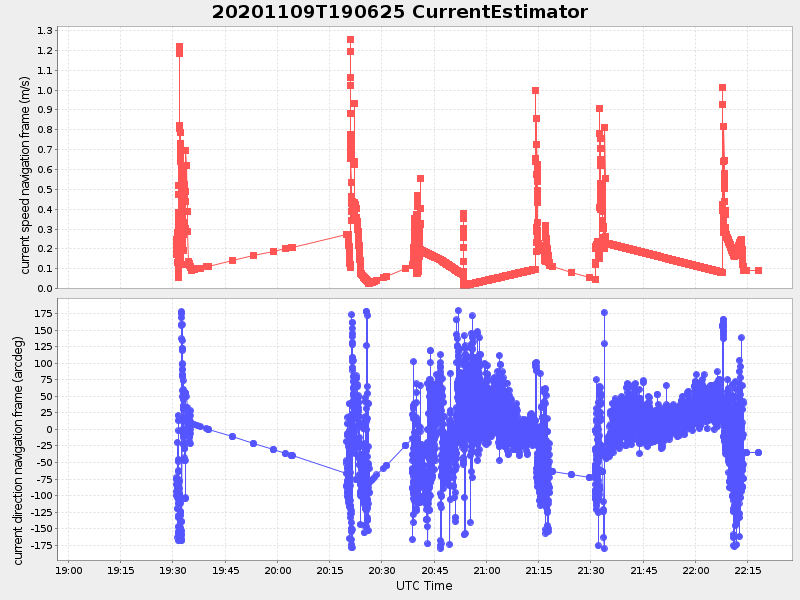
Current (1hr avg) |
|---|---|---|---|
| 2020/11/09 19:06:35 GMT 2020/11/09 11:06:35 local |
2020/11/09 22:18:09 GMT 2020/11/09 14:18:09 local |
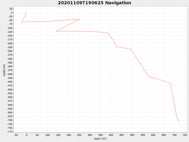
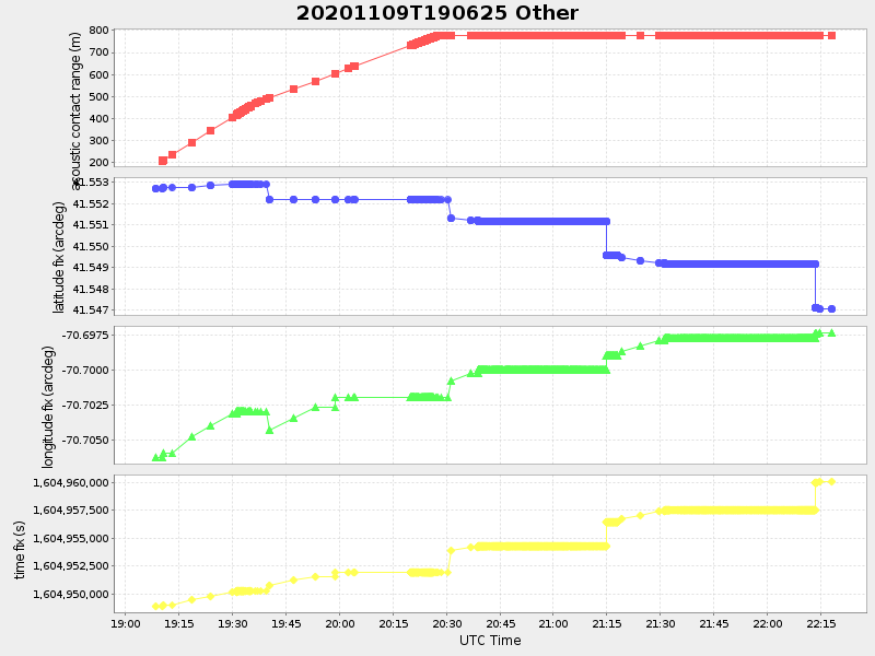
41.54696589103682 -70.69727430106829 |
0.12428249857110793 Amp |
| Downloads: | ||||
| shore.nc shore.mat |
shore.kml shore.kmz |
shore.asc shore.dir |
shore.csv shore.log |
argos_24hr.kml argos_week.kml, argos_month.kml |
| Elapsed time since start: ... | Elapsed time since last valid data: ... |