Parent Directory
Parent Directory
Parent Directory
| Start time | End time | Last Latitude & Longitude |
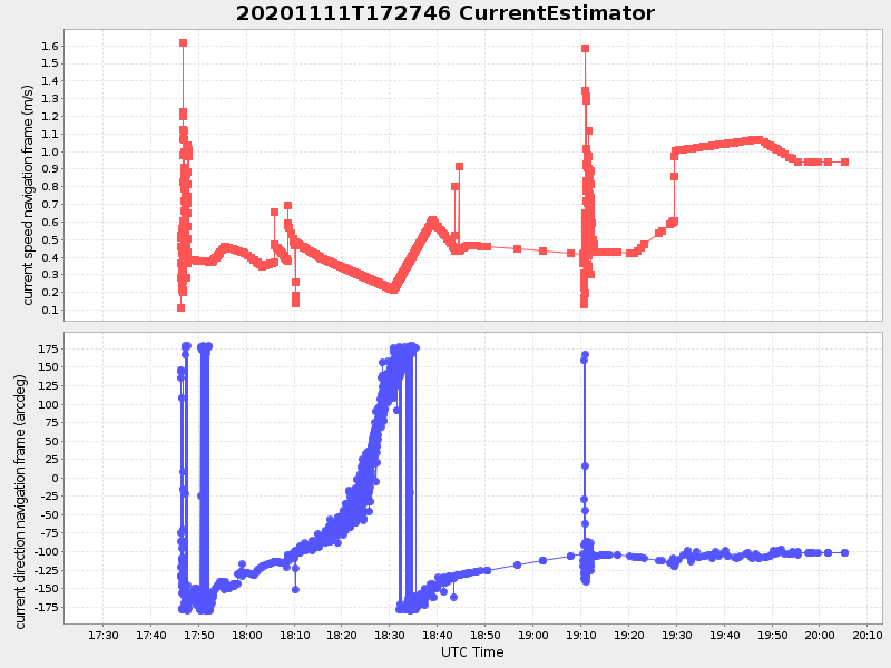
Current (1hr avg) |
|---|---|---|---|
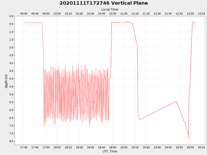
| 2020/11/11 17:29:45 GMT 2020/11/11 09:29:45 local |
2020/11/11 20:05:16 GMT 2020/11/11 12:05:16 local |
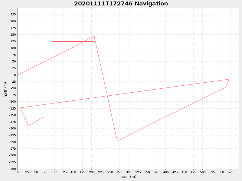
41.552020138474894 -70.70781971544169 |
1.992147068444476 Amp |
| Downloads: | ||||
| shore.nc shore.mat |
shore.kml shore.kmz |
shore.asc shore.dir |
shore.csv shore.log |
argos_24hr.kml argos_week.kml, argos_month.kml |
| Elapsed time since start: 40363:42 | Elapsed time since last valid data: 40361:07 |