Parent Directory
Parent Directory
Parent Directory
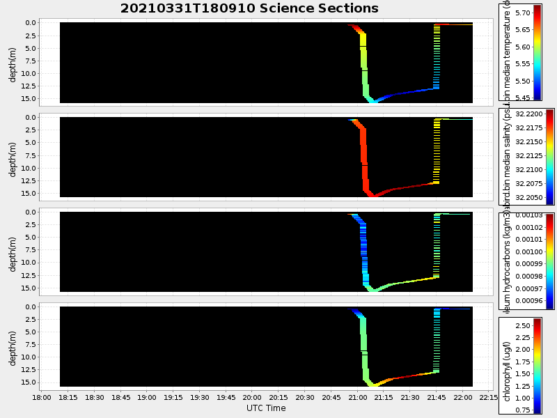
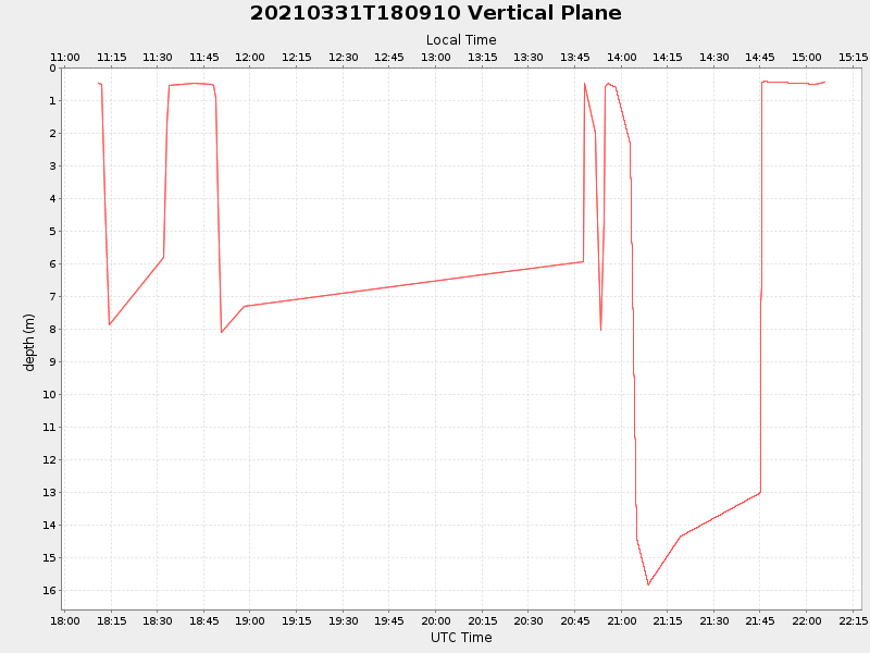
| Start time | End time | Last Latitude & Longitude |
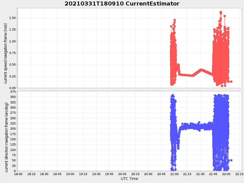
Current (1hr avg) |
|---|---|---|---|
| 2021/03/31 18:10:54 GMT 2021/03/31 11:10:54 local |
2021/03/31 22:05:59 GMT 2021/03/31 15:05:59 local |
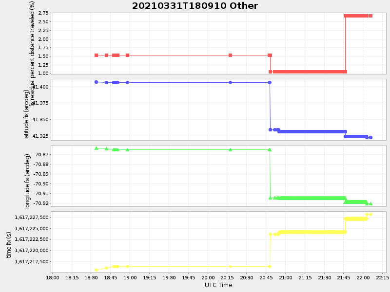
41.32182490340125 -70.9208928577139 |
0.8888311411063454 Amp |
| Downloads: | ||||
| shore.nc shore.mat |
shore.kml shore.kmz |
shore.asc shore.dir |
shore.csv shore.log |
argos_24hr.kml argos_week.kml, argos_month.kml |
| Elapsed time since start: ... | Elapsed time since last valid data: ... |