Parent Directory
Parent Directory
Parent Directory
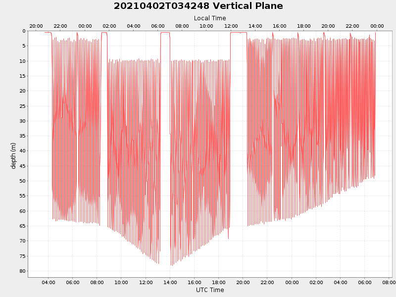
| Start time | End time | Last Latitude & Longitude |
Current (1hr avg) |
|---|---|---|---|
| 2021/04/02 03:42:59 GMT 2021/04/01 20:42:59 local |
2021/04/03 06:53:44 GMT 2021/04/02 23:53:44 local |
40.85410086656261 -70.8834359493944 |
3.5177571621422175 Amp |
| Downloads: | ||||
| shore.nc shore.mat |
shore.kml shore.kmz |
shore.asc shore.dir |
shore.csv shore.log |
argos_24hr.kml argos_week.kml, argos_month.kml |
| Elapsed time since start: ... | Elapsed time since last valid data: ... |