Parent Directory
Parent Directory
Parent Directory
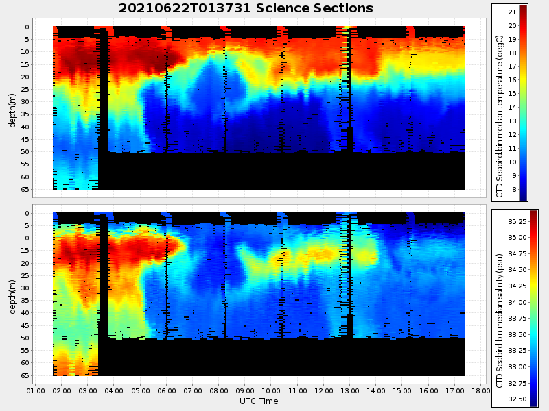
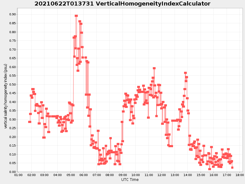
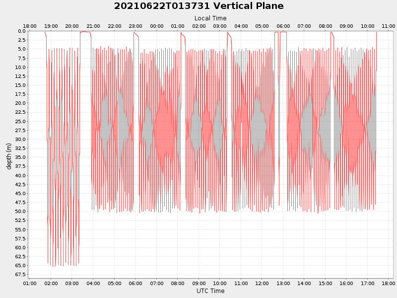
| Start time | End time | Last Latitude & Longitude |
Current (1hr avg) |
|---|---|---|---|
| 2021/06/22 01:42:56 GMT 2021/06/21 18:42:56 local |
2021/06/22 17:25:52 GMT 2021/06/22 10:25:52 local |
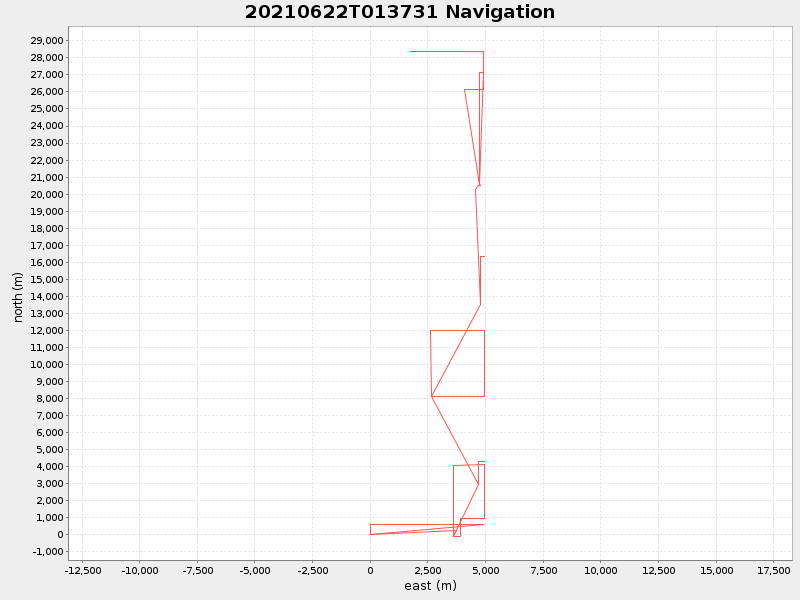
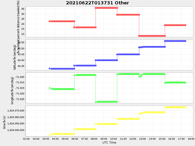
40.5832500072598 -71.0378155343971 |
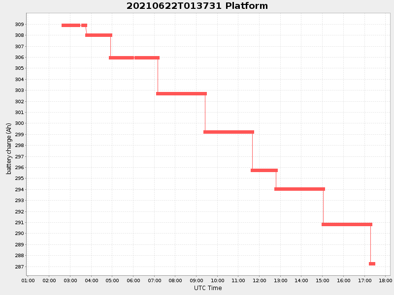
3.5338642979428863 Amp |
| Downloads: | ||||
| shore.nc shore.mat |
shore.kml shore.kmz |
shore.asc shore.dir |
shore.csv shore.log |
argos_24hr.kml argos_week.kml, argos_month.kml |
| Elapsed time since start: ... | Elapsed time since last valid data: ... |