Parent Directory
Parent Directory
Parent Directory
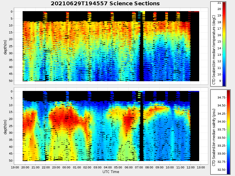
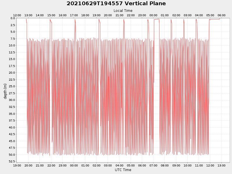
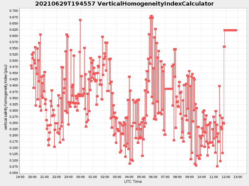
| Start time | End time | Last Latitude & Longitude |
Current (1hr avg) |
|---|---|---|---|
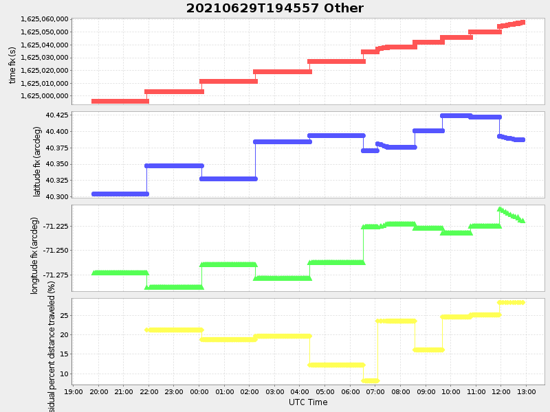
| 2021/06/29 19:48:50 GMT 2021/06/29 12:48:50 local |
2021/06/30 12:52:06 GMT 2021/06/30 05:52:06 local |
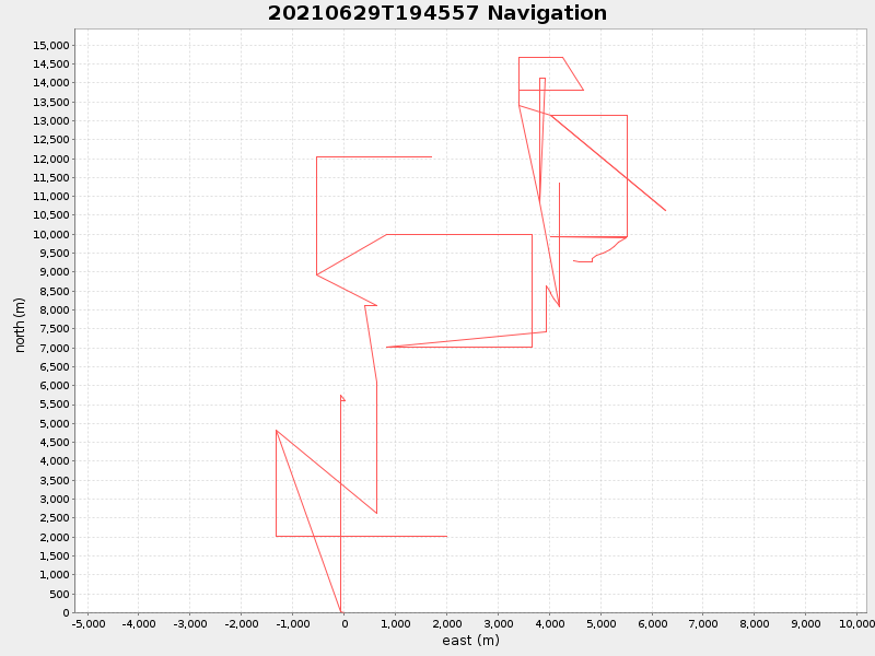
40.38729416656806 -71.21955566660084 |
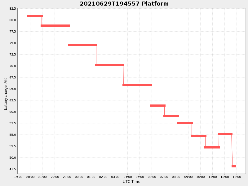
7.10291187439948 Amp |
| Downloads: | ||||
| shore.nc shore.mat |
shore.kml shore.kmz |
shore.asc shore.dir |
shore.csv shore.log |
argos_24hr.kml argos_week.kml, argos_month.kml |
| Elapsed time since start: ... | Elapsed time since last valid data: ... |