Parent Directory
Parent Directory
Parent Directory
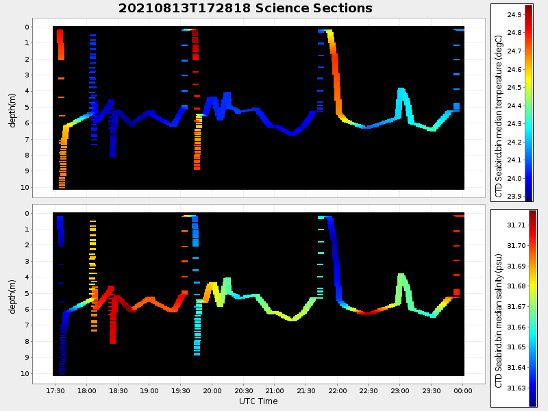
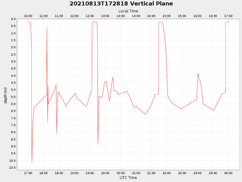
| Start time | End time | Last Latitude & Longitude |
Current (1hr avg) |
|---|---|---|---|
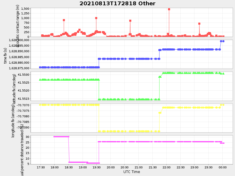
| 2021/08/13 17:28:40 GMT 2021/08/13 10:28:40 local |
2021/08/14 00:02:20 GMT 2021/08/13 17:02:20 local |
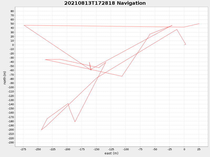
41.55314288166896 -70.70665875170297 |
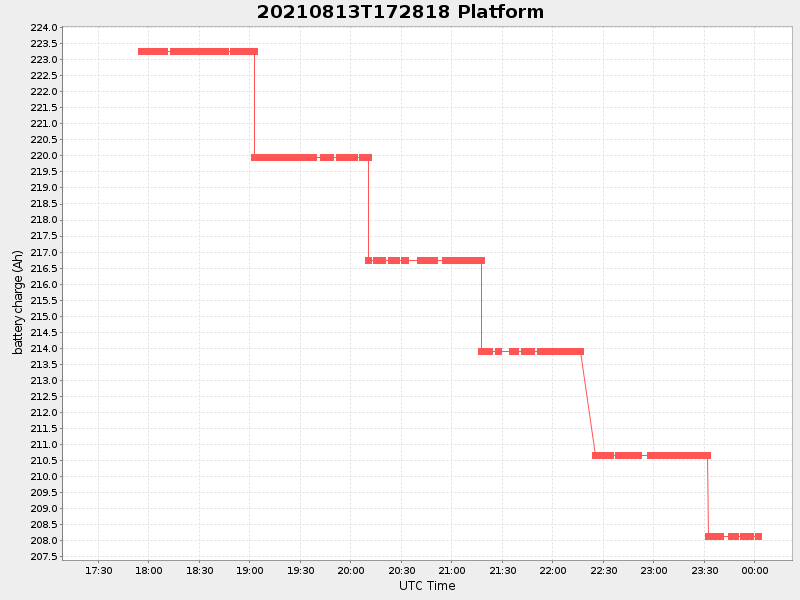
2.4678970579031483 Amp |
| Downloads: | ||||
| shore.nc shore.mat |
shore.kml shore.kmz |
shore.asc shore.dir |
shore.csv shore.log |
argos_24hr.kml argos_week.kml, argos_month.kml |
| Elapsed time since start: 33762:00 | Elapsed time since last valid data: 33755:26 |