Parent Directory
Parent Directory
Parent Directory
| Start time | End time | Last Latitude & Longitude |
Current (1hr avg) |
|---|---|---|---|
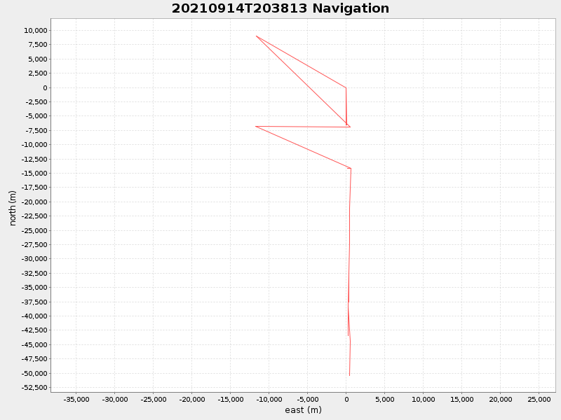
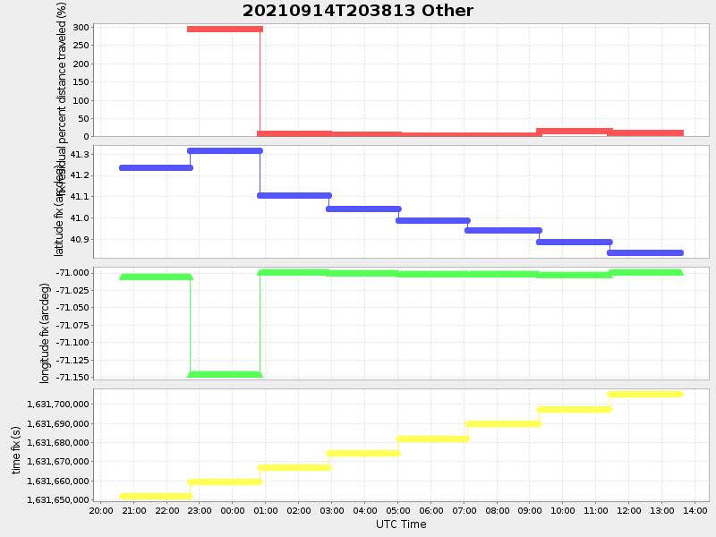
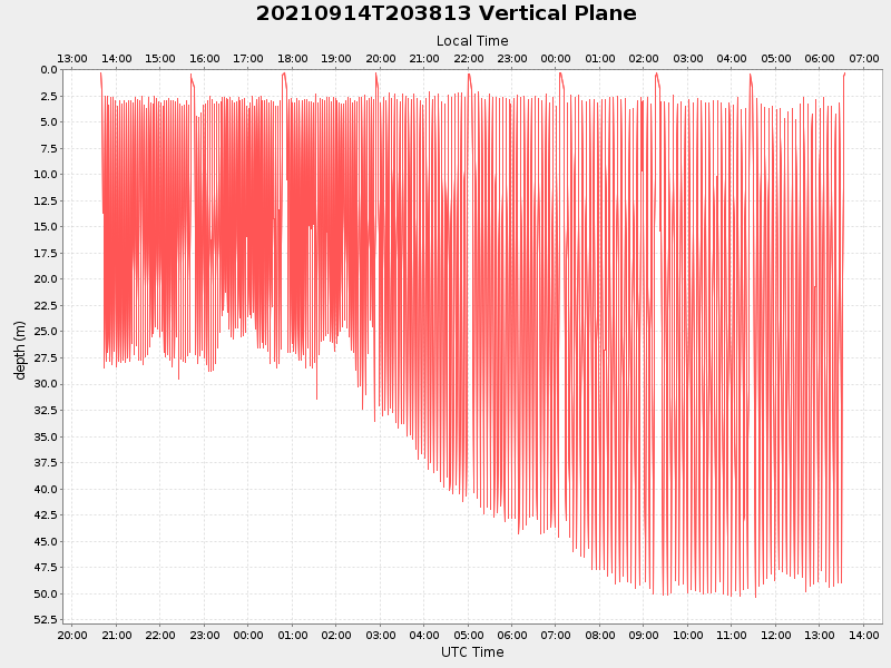
| 2021/09/14 20:38:54 GMT 2021/09/14 13:38:54 local |
2021/09/15 13:34:35 GMT 2021/09/15 06:34:35 local |
40.780976459851416 -71.00093519509565 |
3.293539917688417 Amp |
| Downloads: | ||||
| shore.nc shore.mat |
shore.kml shore.kmz |
shore.asc shore.dir |
shore.csv shore.log |
argos_24hr.kml argos_week.kml, argos_month.kml |
| Elapsed time since start: ... | Elapsed time since last valid data: ... |