Parent Directory
Parent Directory
Parent Directory
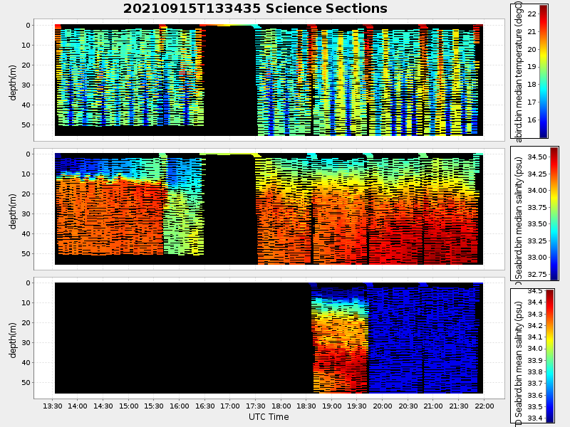
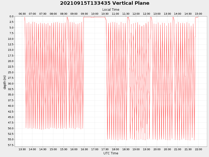
| Start time | End time | Last Latitude & Longitude |
Current (1hr avg) |
|---|---|---|---|
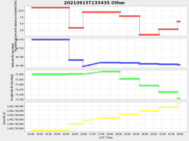
| 2021/09/15 13:34:36 GMT 2021/09/15 06:34:36 local |
2021/09/15 21:59:36 GMT 2021/09/15 14:59:36 local |
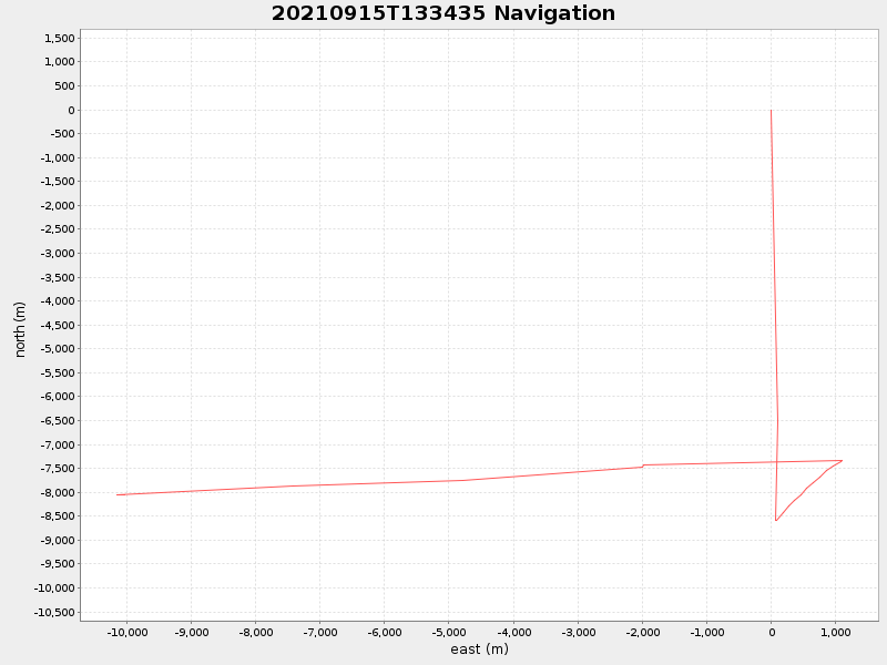
40.702456166593436 -71.11761699922137 |
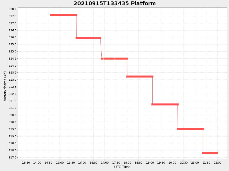
1.6957441949086214 Amp |
| Downloads: | ||||
| shore.nc shore.mat |
shore.kml shore.kmz |
shore.asc shore.dir |
shore.csv shore.log |
argos_24hr.kml argos_week.kml, argos_month.kml |
| Elapsed time since start: ... | Elapsed time since last valid data: ... |