Parent Directory
Parent Directory
Parent Directory
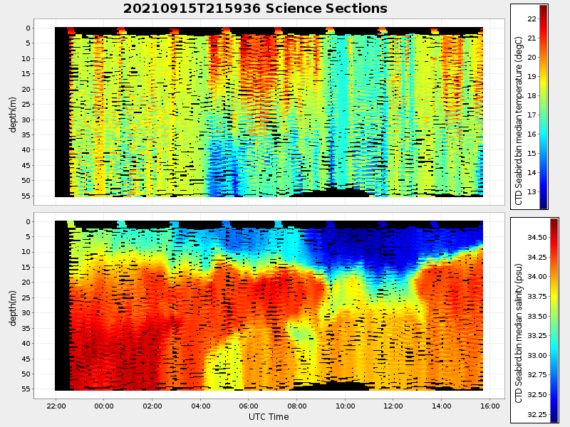
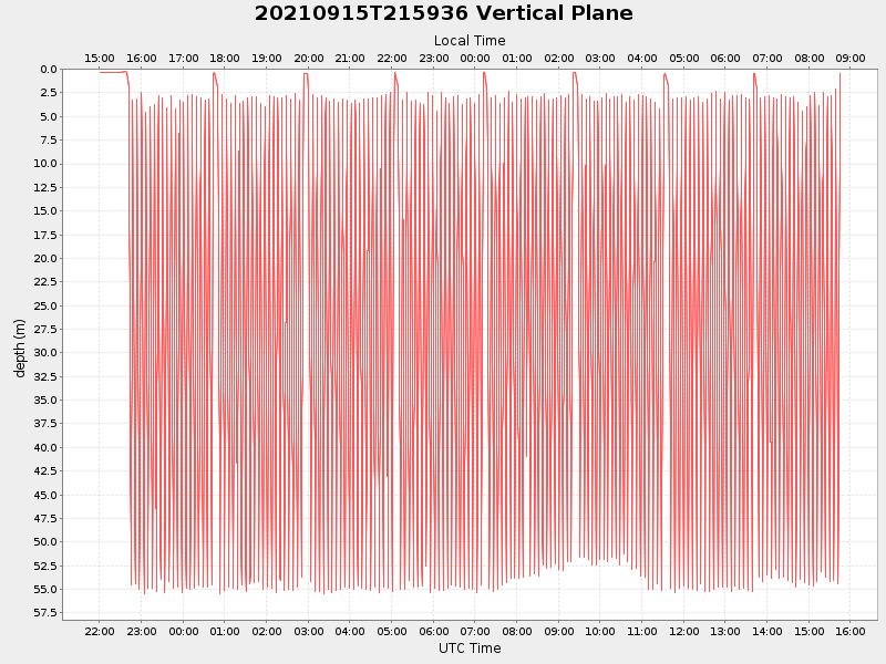
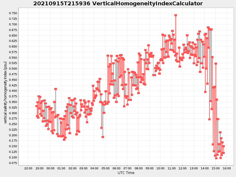
| Start time | End time | Last Latitude & Longitude |
Current (1hr avg) |
|---|---|---|---|
| 2021/09/15 22:00:39 GMT 2021/09/15 15:00:39 local |
2021/09/16 15:45:10 GMT 2021/09/16 08:45:10 local |
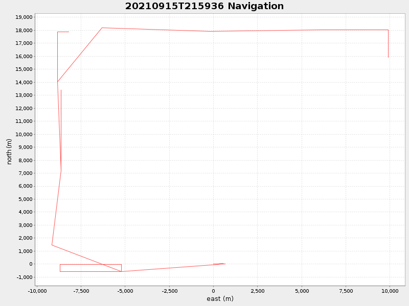
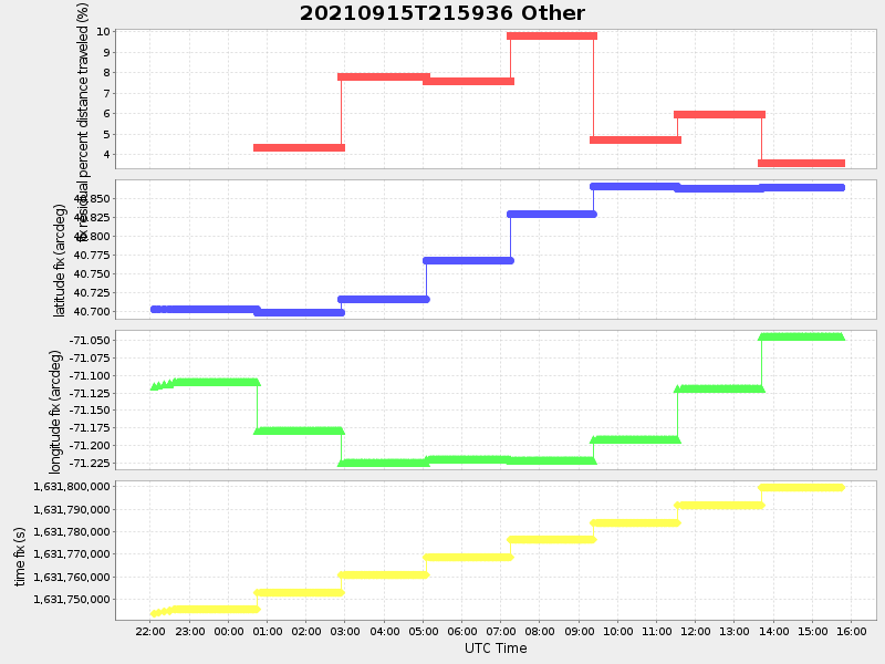
40.845444096211274 -70.99999468588432 |
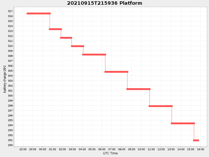
3.4306525611906036 Amp |
| Downloads: | ||||
| shore.nc shore.mat |
shore.kml shore.kmz |
shore.asc shore.dir |
shore.csv shore.log |
argos_24hr.kml argos_week.kml, argos_month.kml |
| Elapsed time since start: ... | Elapsed time since last valid data: ... |