Parent Directory
Parent Directory
Parent Directory
| Start time | End time | Last Latitude & Longitude |
Current (1hr avg) |
|---|---|---|---|
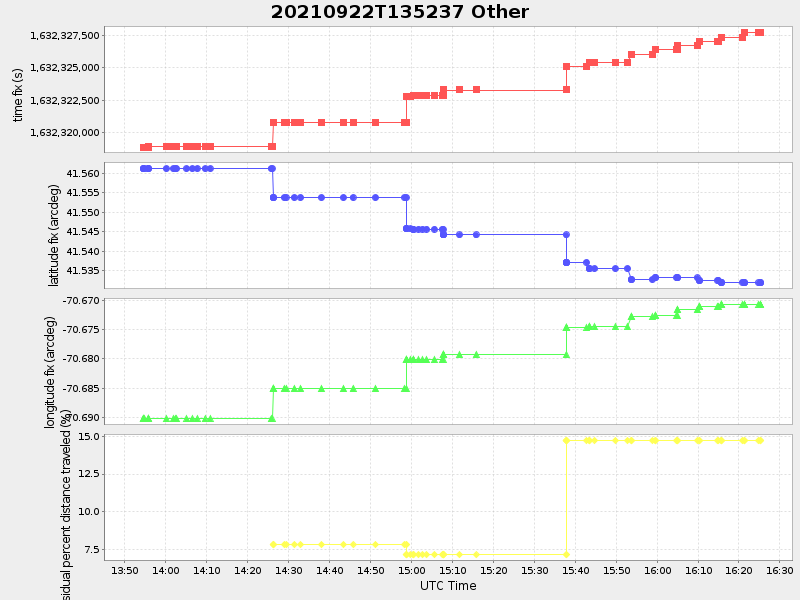
| 2021/09/22 13:52:50 GMT 2021/09/22 06:52:50 local |
2021/09/22 16:25:19 GMT 2021/09/22 09:25:19 local |
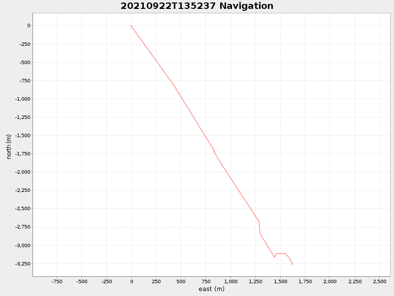
41.53187283299387 -70.67069149997081 |
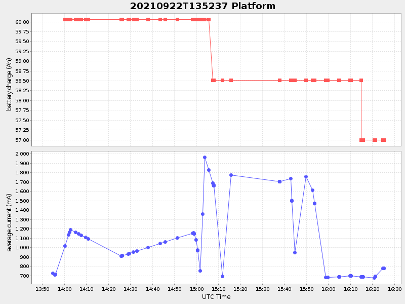
1.3186157612885485 Amp |
| Downloads: | ||||
| shore.nc shore.mat |
shore.kml shore.kmz |
shore.asc shore.dir |
shore.csv shore.log |
argos_24hr.kml argos_week.kml, argos_month.kml |
| Elapsed time since start: ... | Elapsed time since last valid data: ... |