Parent Directory
Parent Directory
Parent Directory
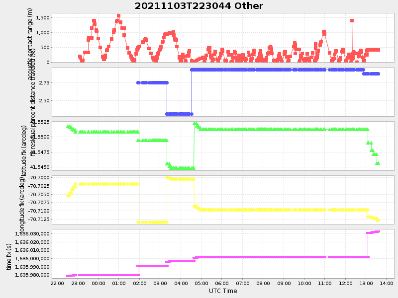
| Start time | End time | Last Latitude & Longitude |
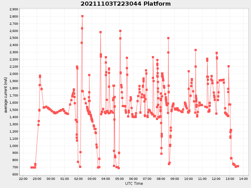
Current (1hr avg) |
|---|---|---|---|
| 2021/11/03 22:30:58 GMT 2021/11/03 15:30:58 local |
2021/11/04 13:36:35 GMT 2021/11/04 06:36:35 local |
41.5450336749602 -70.71310795355474 |
NaN Amp |
| Downloads: | ||||
| shore.nc shore.mat |
shore.kml shore.kmz |
shore.asc shore.dir |
shore.csv shore.log |
argos_24hr.kml argos_week.kml, argos_month.kml |
| Elapsed time since start: ... | Elapsed time since last valid data: ... |