Parent Directory
Parent Directory
Parent Directory
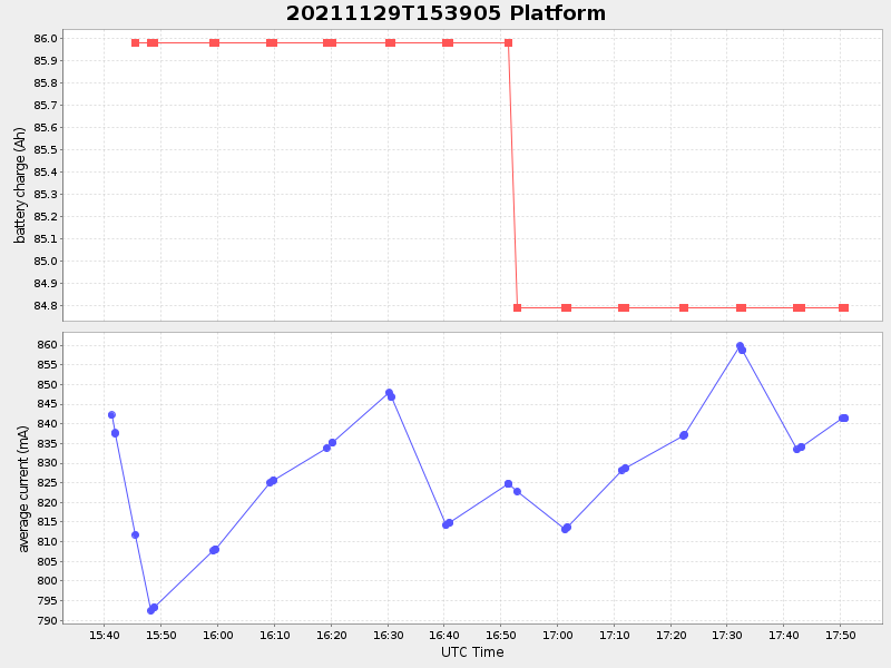
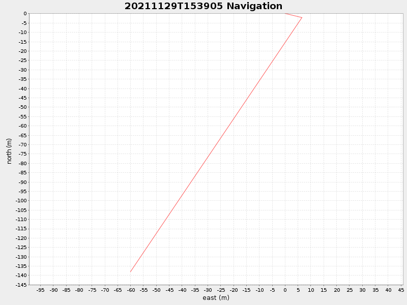
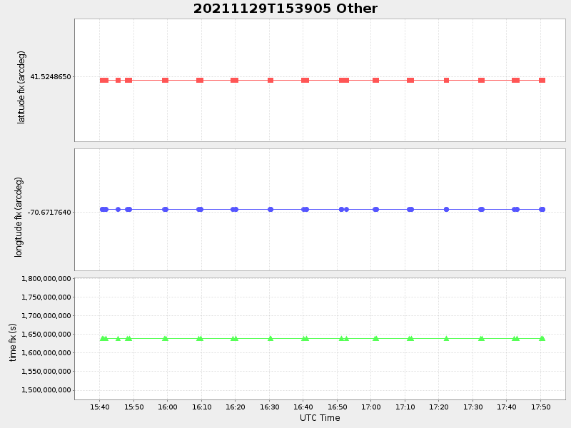
| Start time | End time | Last Latitude & Longitude |
Current (1hr avg) |
|---|---|---|---|
| 2021/11/29 15:39:18 GMT 2021/11/29 07:39:18 local |
2021/11/29 17:50:46 GMT 2021/11/29 09:50:46 local |
41.52362305920774 -70.67248423619743 |
1.0237755977716656 Amp |
| Downloads: | ||||
| shore.nc shore.mat |
shore.kml shore.kmz |
shore.asc shore.dir |
shore.csv shore.log |
argos_24hr.kml argos_week.kml, argos_month.kml |
| Elapsed time since start: ... | Elapsed time since last valid data: ... |