Parent Directory
Parent Directory
Parent Directory
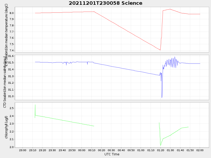
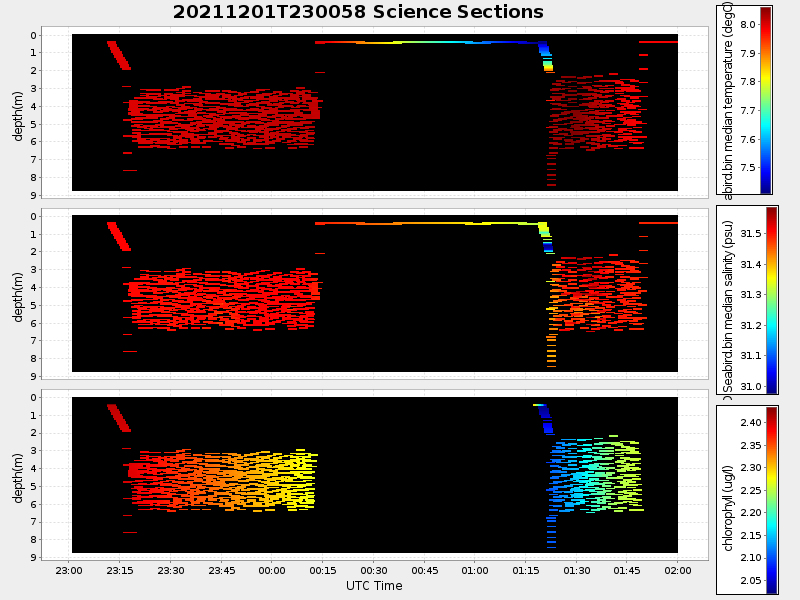
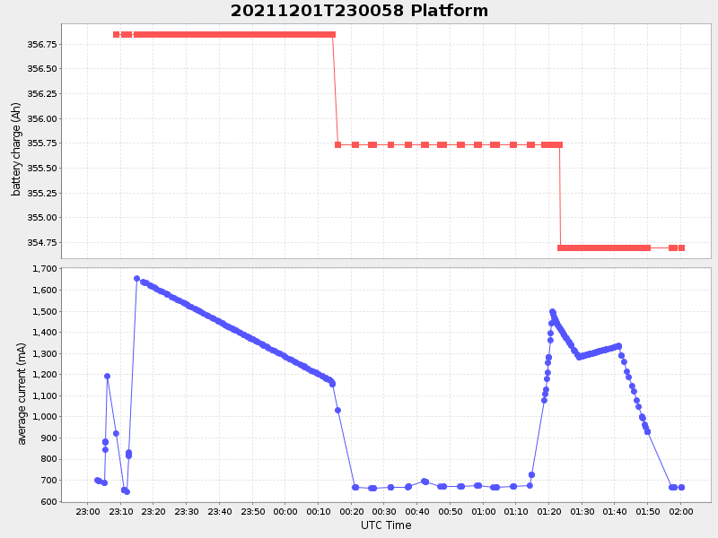
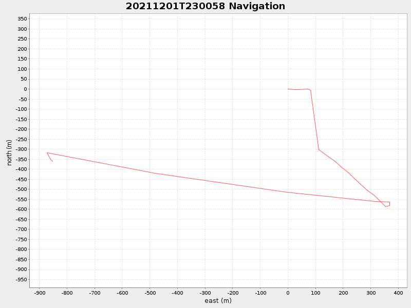
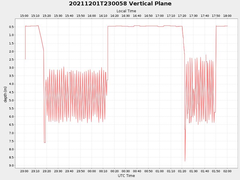
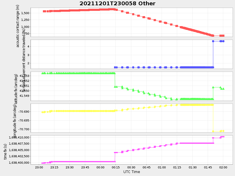
| Start time | End time | Last Latitude & Longitude |
Current (1hr avg) |
|---|---|---|---|
| 2021/12/01 23:01:10 GMT 2021/12/01 15:01:10 local |
2021/12/02 02:00:14 GMT 2021/12/01 18:00:14 local |
41.55034946603303 -70.70078209512745 |
1.0157088527548928 Amp |
| Downloads: | ||||
| shore.nc shore.mat |
shore.kml shore.kmz |
shore.asc shore.dir |
shore.csv shore.log |
argos_24hr.kml argos_week.kml, argos_month.kml |
| Elapsed time since start: ... | Elapsed time since last valid data: ... |