Parent Directory
Parent Directory
Parent Directory
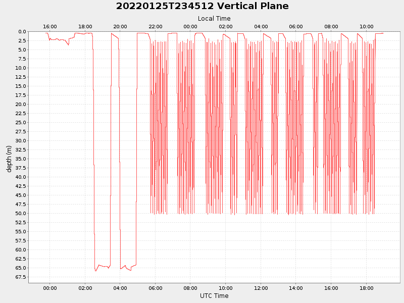
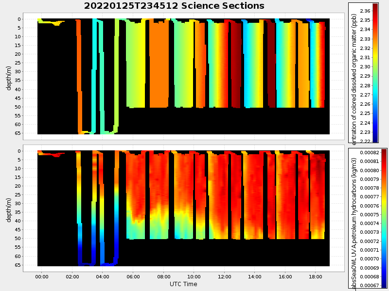
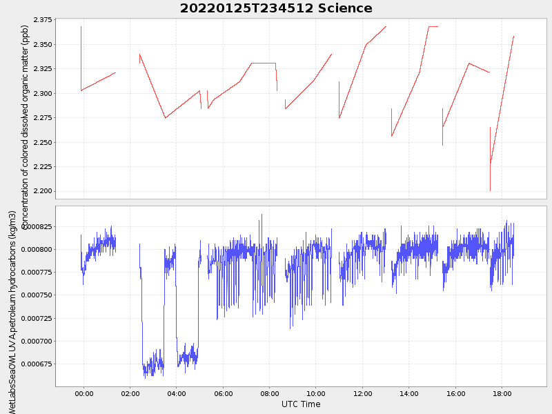
| Start time | End time | Last Latitude & Longitude |
Current (1hr avg) |
|---|---|---|---|
| 2022/01/25 23:46:11 GMT 2022/01/25 15:46:11 local |
2022/01/26 18:57:31 GMT 2022/01/26 10:57:31 local |
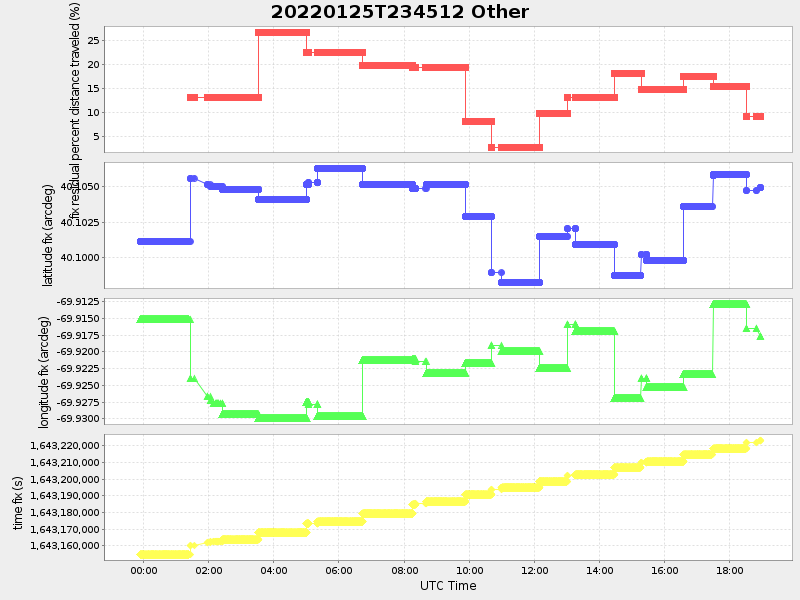
40.10500280794031 -69.91773886802974 |
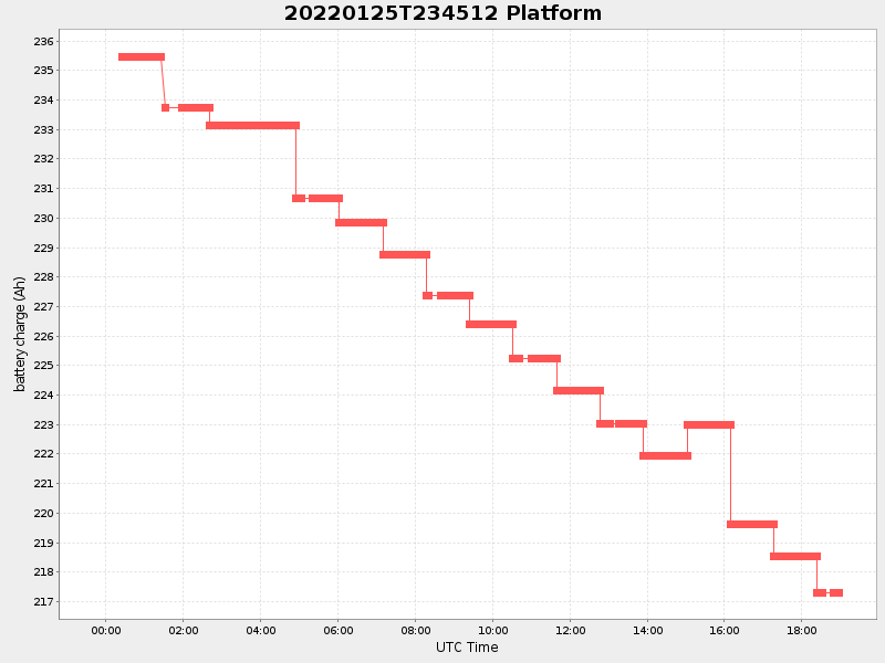
1.2044053953442002 Amp |
| Downloads: | ||||
| shore.nc shore.mat |
shore.kml shore.kmz |
shore.asc shore.dir |
shore.csv shore.log |
argos_24hr.kml argos_week.kml, argos_month.kml |
| Elapsed time since start: ... | Elapsed time since last valid data: ... |