Parent Directory
Parent Directory
Parent Directory
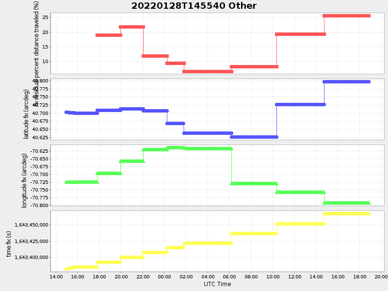
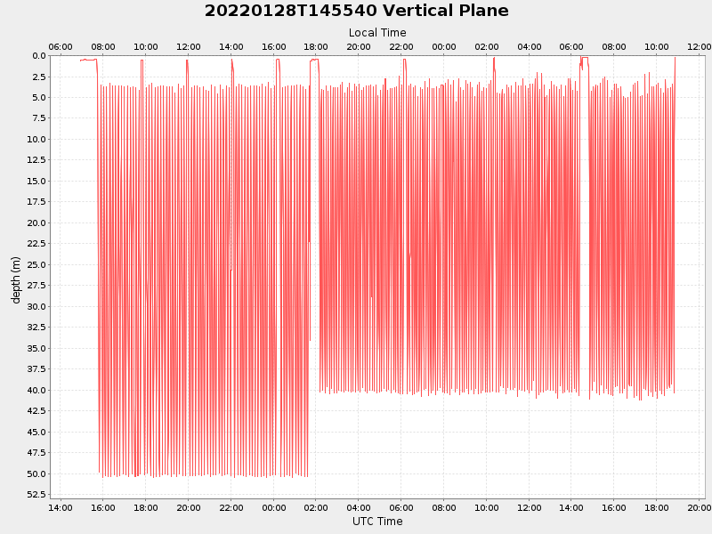
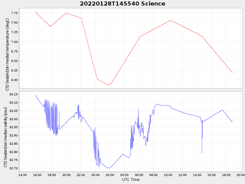
| Start time | End time | Last Latitude & Longitude |
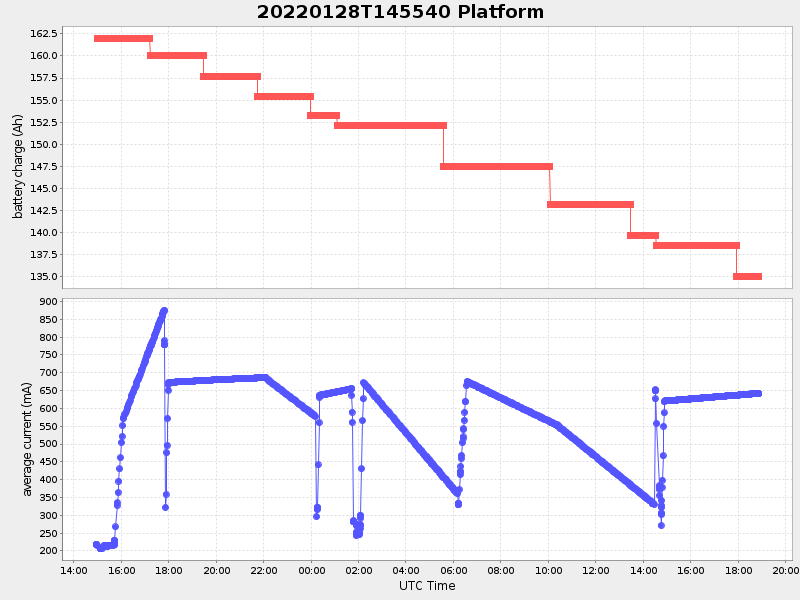
Current (1hr avg) |
|---|---|---|---|
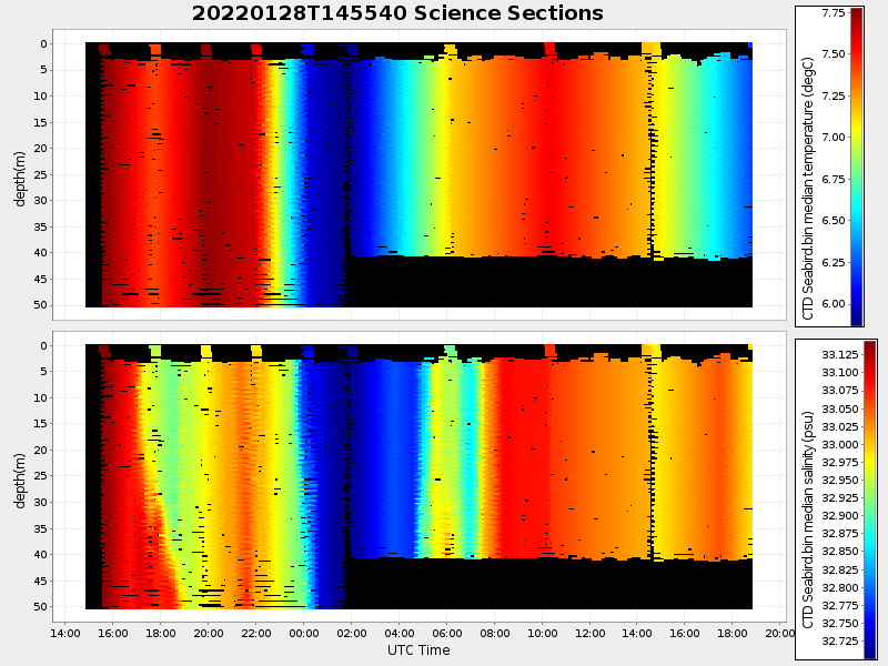
| 2022/01/28 14:56:09 GMT 2022/01/28 06:56:09 local |
2022/01/29 18:52:42 GMT 2022/01/29 10:52:42 local |
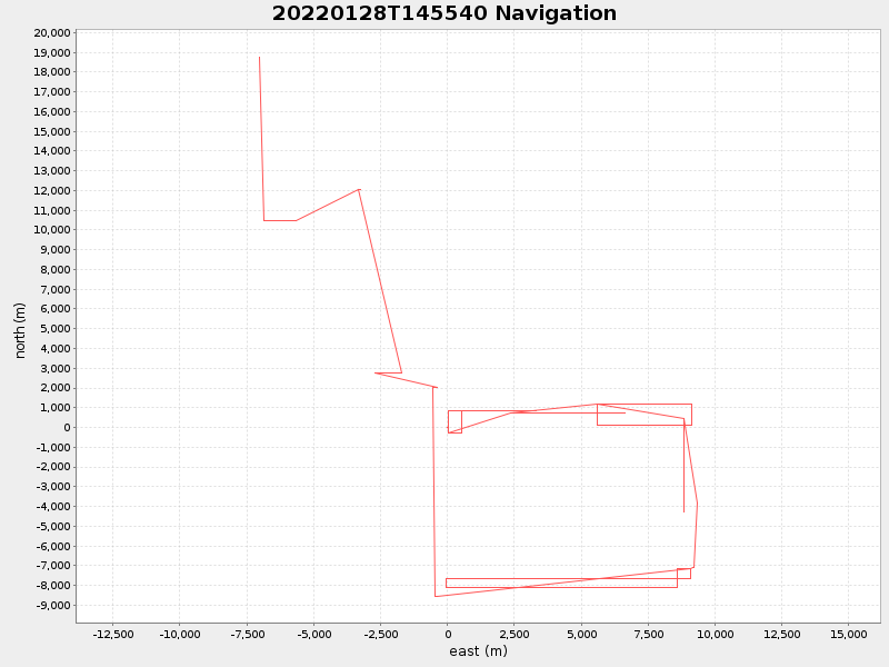
40.87130546024519 -70.80857296313656 |
3.444792240520001 Amp |
| Downloads: | ||||
| shore.nc shore.mat |
shore.kml shore.kmz |
shore.asc shore.dir |
shore.csv shore.log |
argos_24hr.kml argos_week.kml, argos_month.kml |
| Elapsed time since start: ... | Elapsed time since last valid data: ... |