Parent Directory
Parent Directory
Parent Directory
| Start time | End time | Last Latitude & Longitude |
Current (1hr avg) |
|---|---|---|---|
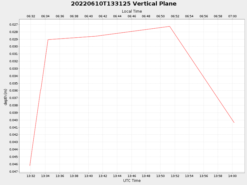
| 2022/06/10 13:31:50 GMT 2022/06/10 06:31:50 local |
2022/06/10 14:00:16 GMT 2022/06/10 07:00:16 local |
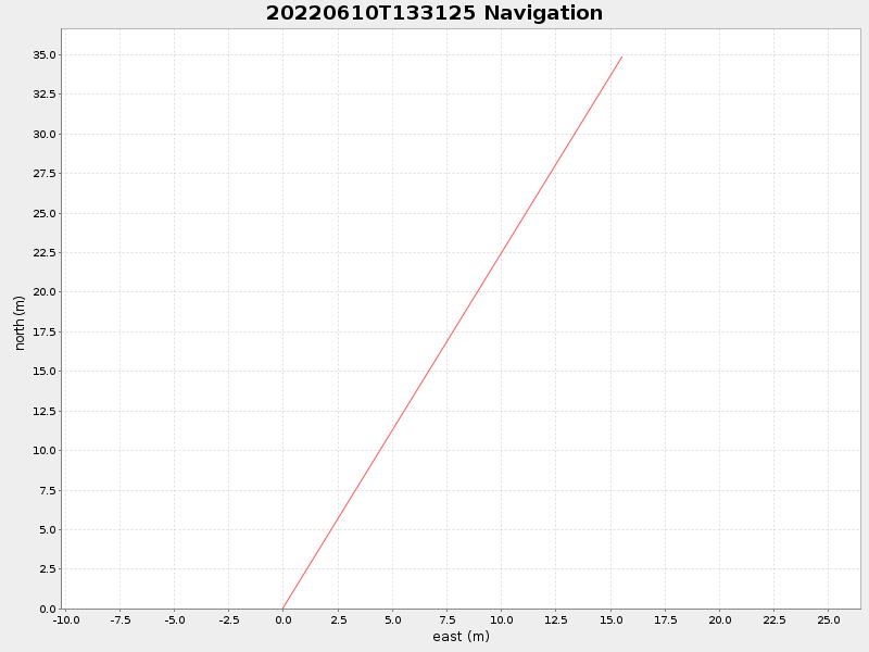
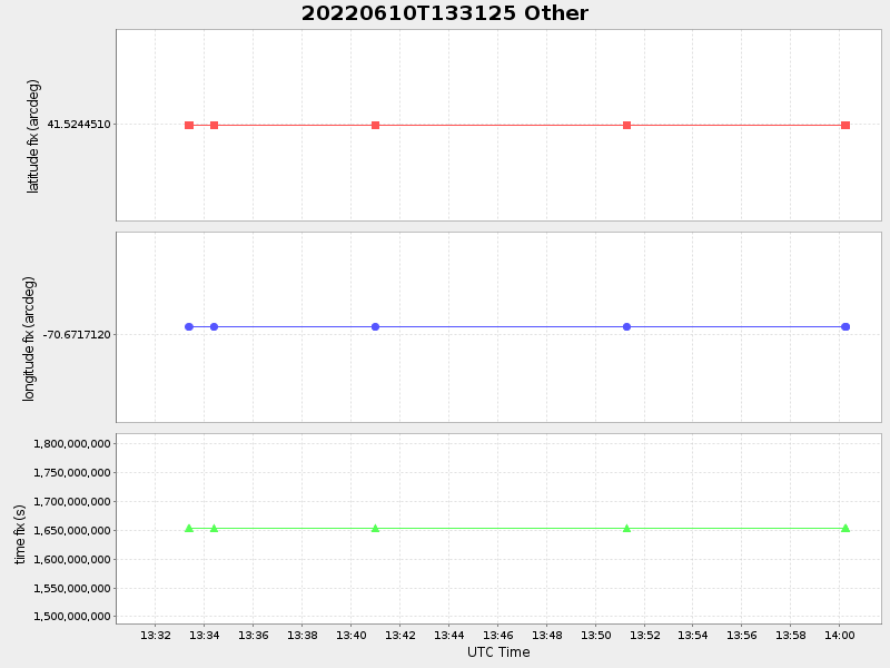
41.52476450579763 -70.67152565766729 |
-0.0 Amp |
| Downloads: | ||||
| shore.nc shore.mat |
shore.kml shore.kmz |
shore.asc shore.dir |
shore.csv shore.log |
argos_24hr.kml argos_week.kml, argos_month.kml |
| Elapsed time since start: 27005:02 | Elapsed time since last valid data: 27004:34 |