Parent Directory
Parent Directory
Parent Directory
| Start time | End time | Last Latitude & Longitude |
Current (1hr avg) |
|---|---|---|---|
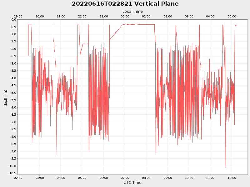
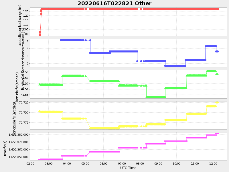
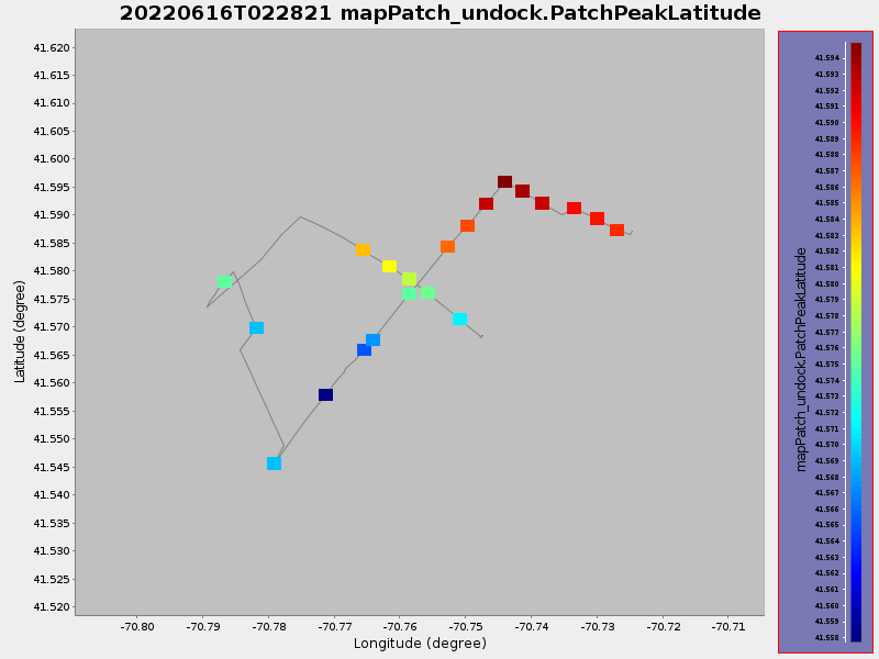
| 2022/06/16 02:28:33 GMT 2022/06/15 19:28:33 local |
2022/06/16 12:15:24 GMT 2022/06/16 05:15:24 local |
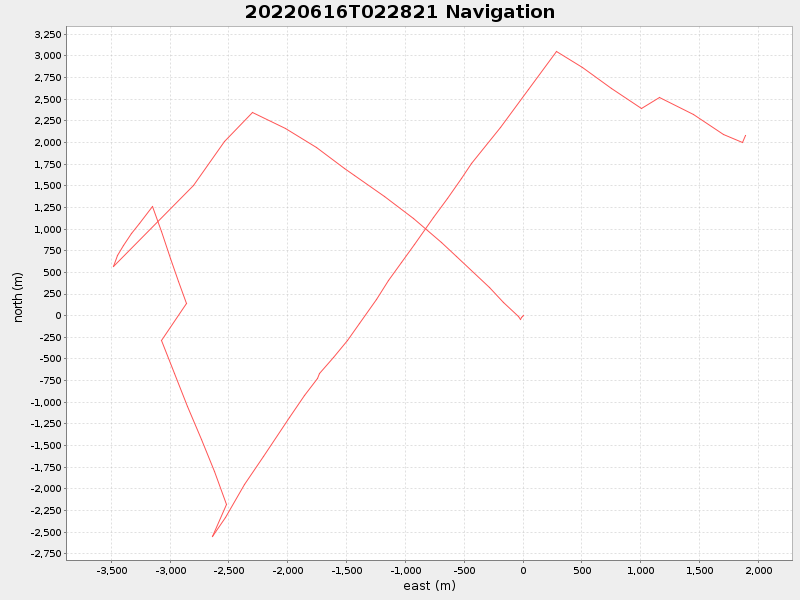
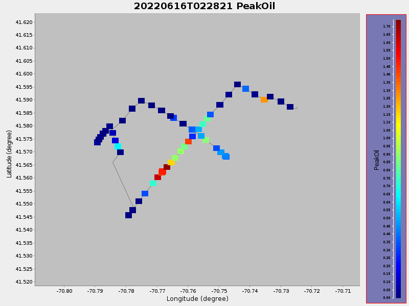
41.587217771211506 -70.72463969910437 |
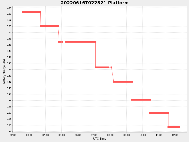
2.223416974722756 Amp |
| Downloads: | ||||
| shore.nc shore.mat |
shore.kml shore.kmz |
shore.asc shore.dir |
shore.csv shore.log |
argos_24hr.kml argos_week.kml, argos_month.kml |
| Elapsed time since start: ... | Elapsed time since last valid data: ... |