Parent Directory
Parent Directory
Parent Directory
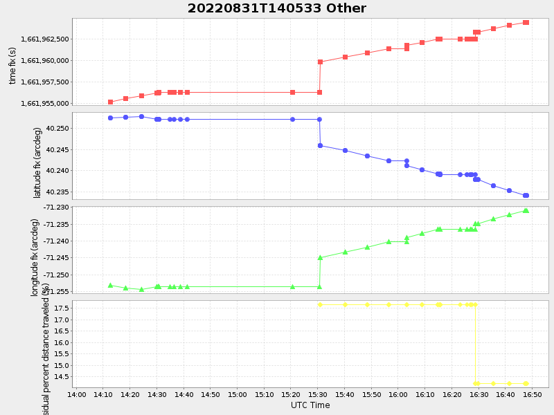
| Start time | End time | Last Latitude & Longitude |
Current (1hr avg) |
|---|---|---|---|
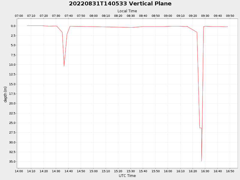
| 2022/08/31 14:06:43 GMT 2022/08/31 07:06:43 local |
2022/08/31 16:48:00 GMT 2022/08/31 09:48:00 local |
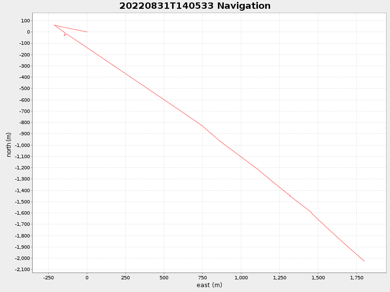
40.23397248882186 -71.2307622211078 |
-0.0 Amp |
| Downloads: | ||||
| shore.nc shore.mat |
shore.kml shore.kmz |
shore.asc shore.dir |
shore.csv shore.log |
argos_24hr.kml argos_week.kml, argos_month.kml |
| Elapsed time since start: 24591:28 | Elapsed time since last valid data: 24588:47 |