Parent Directory
Parent Directory
Parent Directory
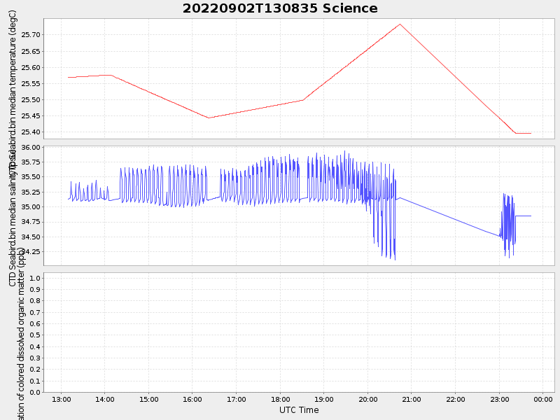
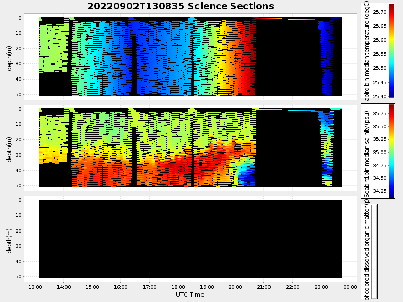
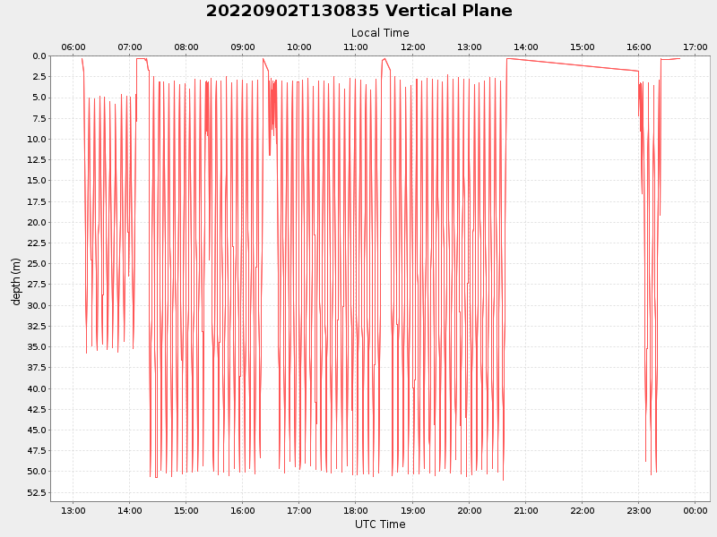
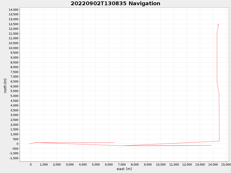
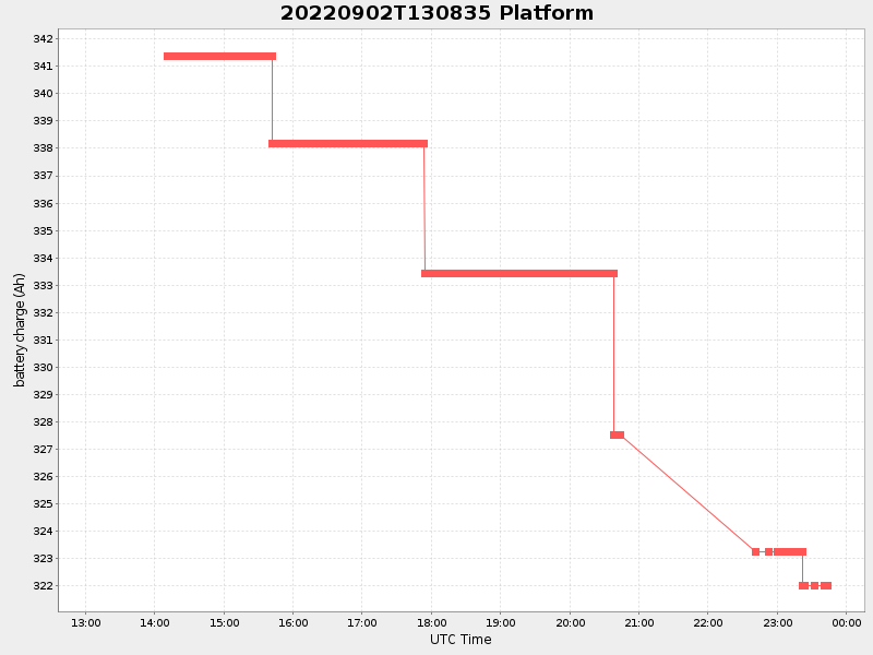
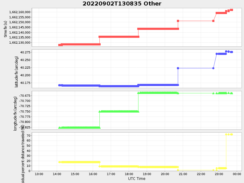
| Start time | End time | Last Latitude & Longitude |
Current (1hr avg) |
|---|---|---|---|
| 2022/09/02 13:08:35 GMT 2022/09/02 06:08:35 local |
2022/09/02 23:43:50 GMT 2022/09/02 16:43:50 local |
40.276038619235166 -70.66332486997788 |
1.1777739625786752 Amp |
| Downloads: | ||||
| shore.nc shore.mat |
shore.kml shore.kmz |
shore.asc shore.dir |
shore.csv shore.log |
argos_24hr.kml argos_week.kml, argos_month.kml |
| Elapsed time since start: ... | Elapsed time since last valid data: ... |