Parent Directory
Parent Directory
Parent Directory
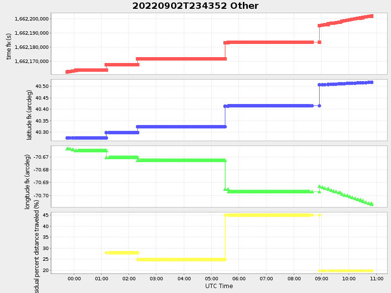
| Start time | End time | Last Latitude & Longitude |
Current (1hr avg) |
|---|---|---|---|
| 2022/09/02 23:44:03 GMT 2022/09/02 16:44:03 local |
2022/09/03 10:50:08 GMT 2022/09/03 03:50:08 local |
40.51755903999689 -70.70699247131071 |
0.8551726266429593 Amp |
| Downloads: | ||||
| shore.nc shore.mat |
shore.kml shore.kmz |
shore.asc shore.dir |
shore.csv shore.log |
argos_24hr.kml argos_week.kml, argos_month.kml |
| Elapsed time since start: ... | Elapsed time since last valid data: ... |