Parent Directory
Parent Directory
Parent Directory
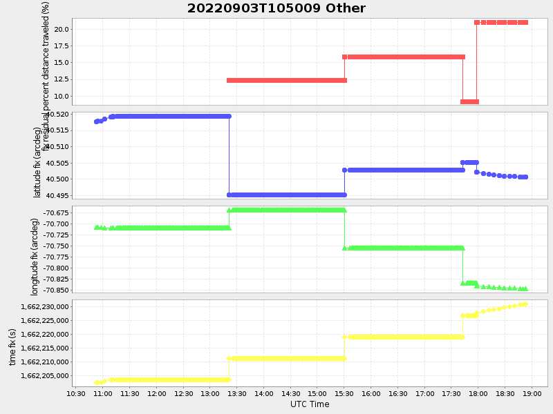
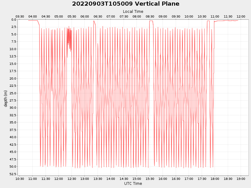
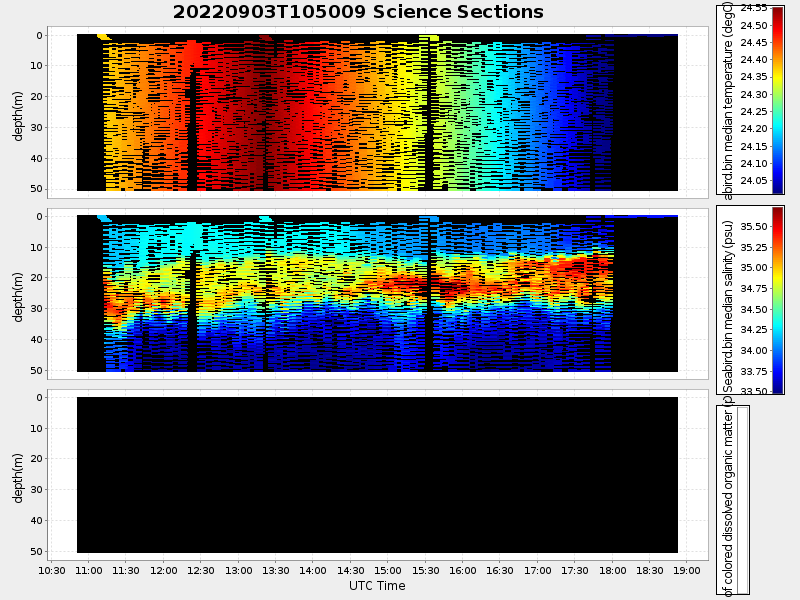
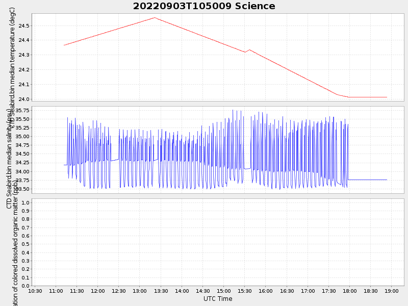
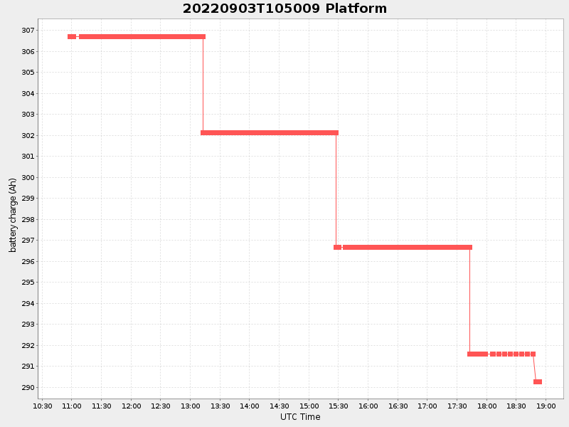
| Start time | End time | Last Latitude & Longitude |
Current (1hr avg) |
|---|---|---|---|
| 2022/09/03 10:50:21 GMT 2022/09/03 03:50:21 local |
2022/09/03 18:53:26 GMT 2022/09/03 11:53:26 local |
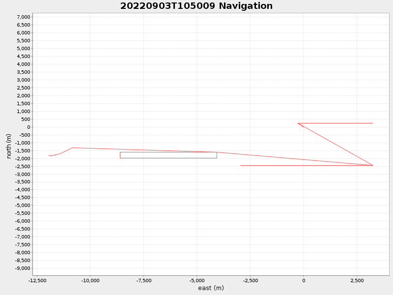
40.500552419247356 -70.84757324491326 |
1.305055680904558 Amp |
| Downloads: | ||||
| shore.nc shore.mat |
shore.kml shore.kmz |
shore.asc shore.dir |
shore.csv shore.log |
argos_24hr.kml argos_week.kml, argos_month.kml |
| Elapsed time since start: ... | Elapsed time since last valid data: ... |