Parent Directory
Parent Directory
Parent Directory
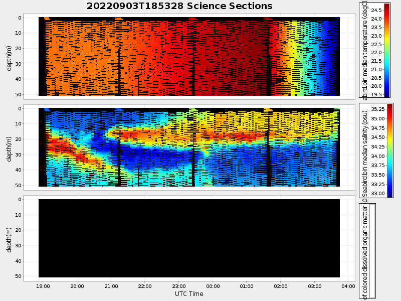
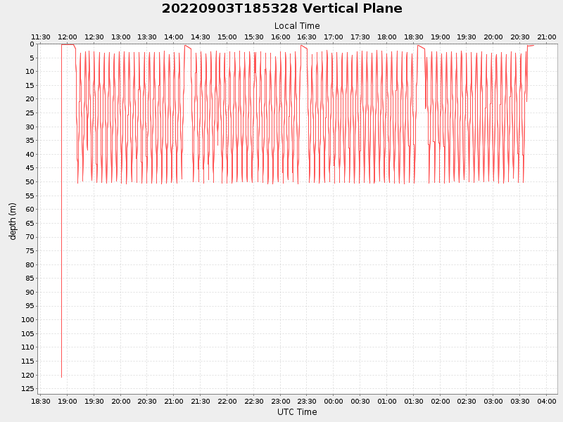
| Start time | End time | Last Latitude & Longitude |
Current (1hr avg) |
|---|---|---|---|
| 2022/09/03 18:53:39 GMT 2022/09/03 11:53:39 local |
2022/09/04 03:45:47 GMT 2022/09/03 20:45:47 local |
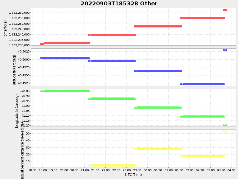
40.502827870672554 -71.19392289045555 |
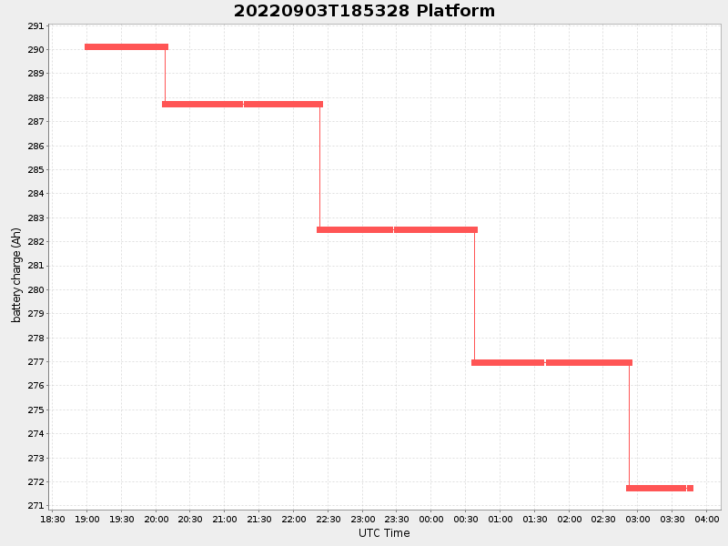
5.210988482618233 Amp |
| Downloads: | ||||
| shore.nc shore.mat |
shore.kml shore.kmz |
shore.asc shore.dir |
shore.csv shore.log |
argos_24hr.kml argos_week.kml, argos_month.kml |
| Elapsed time since start: ... | Elapsed time since last valid data: ... |