Parent Directory
Parent Directory
Parent Directory
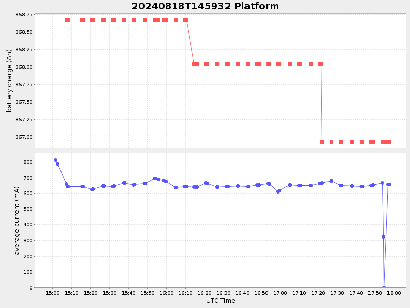
| Start time | End time | Last Latitude & Longitude |
Current (1hr avg) |
|---|---|---|---|
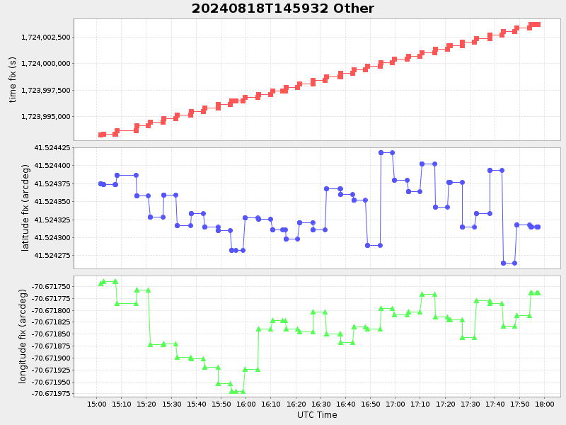
| 2024/08/18 14:59:53 GMT 2024/08/18 07:59:53 local |
2024/08/18 17:57:24 GMT 2024/08/18 10:57:24 local |
41.524315166561884 -70.67176316598974 |
1.064671079222934 Amp |
| Downloads: | ||||
| shore.nc shore.mat |
shore.kml shore.kmz |
shore.asc shore.dir |
shore.csv shore.log |
argos_24hr.kml argos_week.kml, argos_month.kml |
| Elapsed time since start: ... | Elapsed time since last valid data: ... |