Parent Directory
Parent Directory
Parent Directory
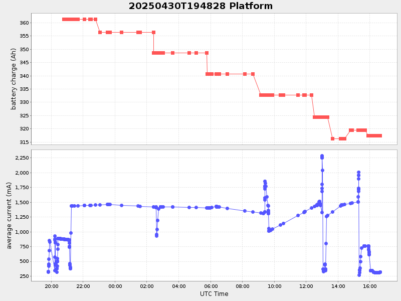
| Start time | End time | Last Latitude & Longitude |
Current (1hr avg) |
|---|---|---|---|
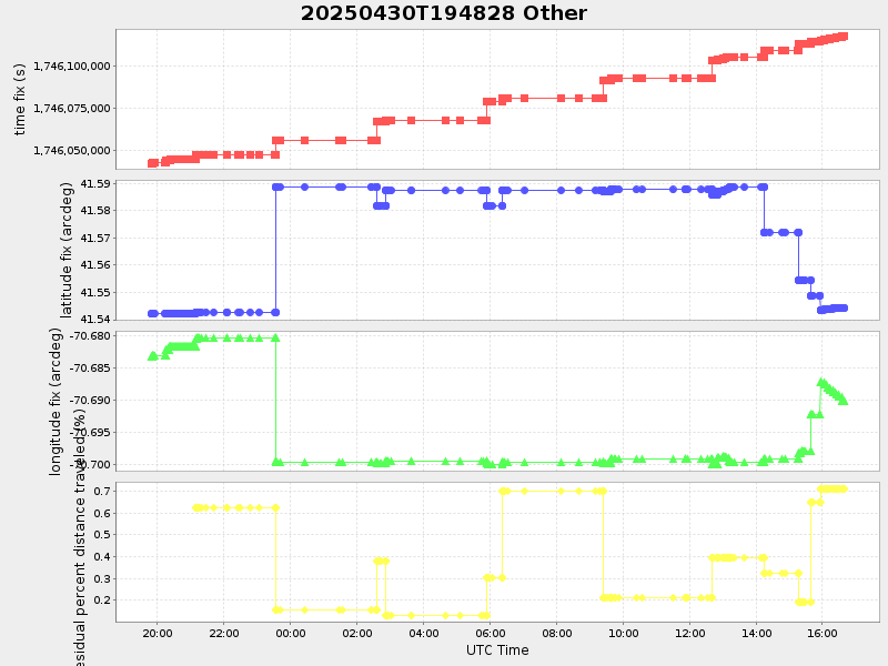
| 2025/04/30 19:48:36 GMT 2025/04/30 12:48:36 local |
2025/05/01 16:39:37 GMT 2025/05/01 09:39:37 local |
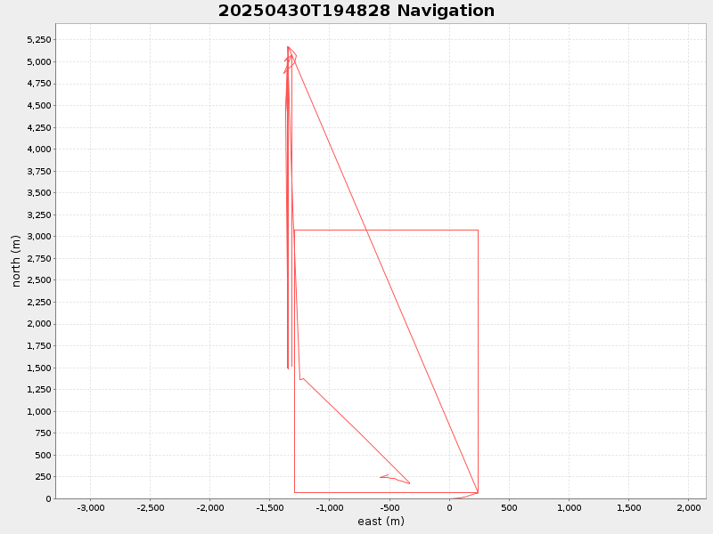
41.544478395671796 -70.68945013344482 |
2.046813112098889 Amp |
| Downloads: | ||||
| shore.nc shore.mat |
shore.kml shore.kmz |
shore.asc shore.dir |
shore.csv shore.log |
argos_24hr.kml argos_week.kml, argos_month.kml |
| Elapsed time since start: ... | Elapsed time since last valid data: ... |